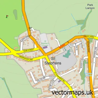
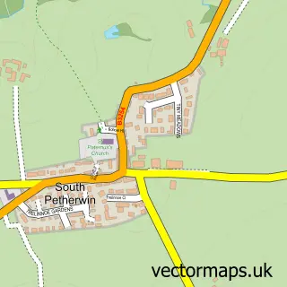
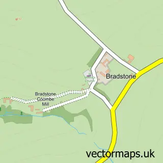
This Launceston street map is a detailed vector street map covering a 750m x 750m area. Select a larger area to create and download your own vector street map of Launceston.
The 750-metre map sample for Launceston covers 372 mapped buildings and approximately 19.7 km of road detail, of which 38 named roads are named. The immediate area includes 1 school, 1 GP surgery within 2 miles, 8 pubs and 1 MOT station, with 7 within 2 miles. The wider area around Launceston features 5 tourism points of interest, 19 food and drink venues and 5 hotels. To create a larger or custom map of Launceston, the map builder lets you define your own coverage area and download editable SVG, PDF and PNG files.
Create a larger editable map of Launceston
Choose any area you need and generate a high-quality vector map instantly. Perfect for print, planning, design, business and personal use.

This Launceston street map in Cornwall is available as downloadable SVG, PDF and PNG map files, or as a printed map for planning, business, display, education, local information and design work. You can also create a larger custom map area using the map selector.
What this Launceston map sample shows
Launceston lies within Launceston Cp parish, part of Launceston South ward in the Cornwall local authority area. The postcode geography for this area includes the PL postcode area, the PL15 postcode district and the PL15 9 postcode sector. Residents fall under the Nhs Cornwall And The Isles Of Scilly Integrated Care Board for NHS services.
Local features near Launceston
Within 2 milesAmenities and services in and around Launceston.
Administrative and postcode information for Launceston
Launceston lies within Launceston Cp parish, part of Launceston South ward in the Cornwall local authority area. The postcode geography for this area includes the PL postcode area, the PL15 postcode district and the PL15 9 postcode sector. Residents fall under the Nhs Cornwall And The Isles Of Scilly Integrated Care Board for NHS services.
Nearby street map samples around Launceston

More street maps in Cornwall
750 metre map area coverage
Boundary, postcode and point of interest information for the 750m x 750m rectangle centred on this sample map.
Boundaries containing map centre
Constituency: North Cornwall Co Const
District: Cornwall
Icb: NHS Cornwall and the Isles of Scilly ICB
Parish: Launceston CP
Police Force: devon and cornwall
Postcode District: PL15
Postcode Sector: PL15 8
Nearby boundaries intersecting sample
Postcode Sector: PL15 7, PL15 9
Postcode coverage
POI category counts
Flowers And Gifts Shop: 10
Professional Services: 10
Beauty Salon: 9
Hair Salon: 8
Pub: 8
Cafe: 6
Automotive Repair: 5
Church Cathedral: 5
Clothing Store: 5
Financial Service: 5
Sample points of interest
- Countryside Accountancy
- Haines Watts Launceston
- Dr Yan's
- Fernbank Advertising
- Fine & Country Launceston
- Roundchase Media Promotions
- Kivells Estate Agents Launceston
- Hypnotherapy South West
- J Wills
- Launceston: St Mary Magdalene
- Burnell & Rowe
- Elkerton-Smith
Create a larger editable map of Launceston
This sample shows only a 750 metre area. To create a larger map of Launceston, use our map builder to choose your own coverage area, add titles and download editable SVG, PDF and PNG files.
Create a custom map of Launceston