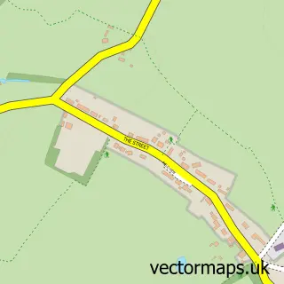
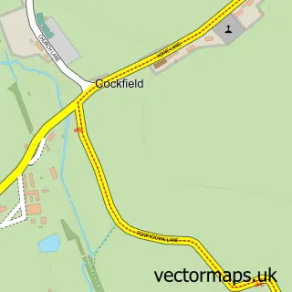
This Lavenham street map is a detailed vector street map covering a 750m x 750m area. Select a larger area to create and download your own vector street map of Lavenham.
The 750-metre map sample for Lavenham covers 297 mapped buildings and approximately 15.7 km of road detail, of which 28 named roads are named. The immediate area includes 1 school, 2 pubs and 1 MOT station within 2 miles. The wider area around Lavenham features 4 tourism points of interest, 7 food and drink venues and 11 hotels. To create a larger or custom map of Lavenham, the map builder lets you define your own coverage area and download editable SVG, PDF and PNG files.
Create a larger editable map of Lavenham
Choose any area you need and generate a high-quality vector map instantly. Perfect for print, planning, design, business and personal use.

This Lavenham street map in Suffolk is available as downloadable SVG, PDF and PNG map files, or as a printed map for planning, business, display, education, local information and design work. You can also create a larger custom map area using the map selector.
What this Lavenham map sample shows
Lavenham lies within Lavenham Cp parish, part of Lavenham ward in the Babergh District local authority area. The postcode geography for this area includes the CO postcode area, the CO10 postcode district and the CO10 9 postcode sector. Residents fall under the Nhs Suffolk And North East Essex Integrated Care Board for NHS services.
Local features near Lavenham
Within 2 milesAmenities and services in and around Lavenham.
Administrative and postcode information for Lavenham
The local authority covering Lavenham is Babergh District, within the county of Suffolk. The settlement lies within Lavenham ward and Lavenham Cp civil parish. The CO10 postcode district and CO10 9 postcode sector serve the immediate area. NHS provision in the area is delivered through West Suffolk Nhs Foundation Trust.
Nearby street map samples around Lavenham

More street maps in Suffolk
750 metre map area coverage
Boundary, postcode and point of interest information for the 750m x 750m rectangle centred on this sample map.
Boundaries containing map centre
Constituency: South Suffolk Co Const
County: Suffolk County
District: Babergh District
Icb: NHS Essex ICB
Parish: Lavenham CP
Police Force: suffolk
Postcode District: CO10
Postcode Sector: CO10 9
Ward: Lavenham Ward
Nearby boundaries intersecting sample
No additional intersecting boundaries found.
Postcode coverage
POI category counts
Hotel: 11
Art Gallery: 7
Tea Room: 7
Flowers And Gifts Shop: 5
Convenience Store: 4
Printing Services: 4
Professional Services: 4
Antique Store: 3
Clothing Store: 3
Hair Salon: 3
Sample points of interest
- Natural Health Centre
- Hydrogen Publicity
- Candle & Blue
- J & J Baker
- Timber Antiques
- Ariel Gallery
- Ariel Gallery
- Crooked House Gallery
- Lavenham Contemporary
- Lion House Gallery
- Rural Charm
- Wildlife Art Gallery (The)
Create a larger editable map of Lavenham
This sample shows only a 750 metre area. To create a larger map of Lavenham, use our map builder to choose your own coverage area, add titles and download editable SVG, PDF and PNG files.
Create a custom map of Lavenham