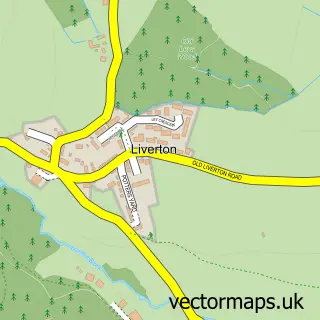
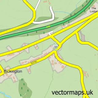
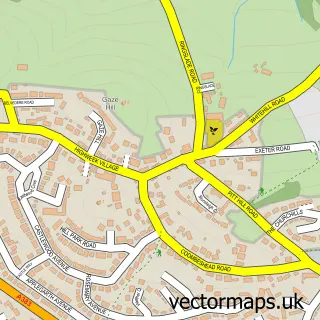
This Liverton Coldeast street map is a detailed vector street map covering a 750m x 750m area. Select a larger area to create and download your own vector street map of Liverton Coldeast.
The 750-metre map sample for Liverton Coldeast covers 350 mapped buildings and approximately 15.4 km of road detail, of which 23 named roads are named. The immediate area includes 2 pubs and 1 MOT station, with 5 within 2 miles. The wider area around Liverton Coldeast features 2 food and drink venues and 1 campsite within 2 miles. To create a larger or custom map of Liverton Coldeast, the map builder lets you define your own coverage area and download editable SVG, PDF and PNG files.
Create a larger editable map of Liverton Coldeast
Choose any area you need and generate a high-quality vector map instantly. Perfect for print, planning, design, business and personal use.

This Liverton Coldeast street map in Devon is available as downloadable SVG, PDF and PNG map files, or as a printed map for planning, business, display, education, local information and design work. You can also create a larger custom map area using the map selector.
What this Liverton Coldeast map sample shows
Liverton Coldeast lies within Ilsington Cp parish, part of Haytor ward in the Teignbridge District local authority area. The postcode geography for this area includes the TQ postcode area, the TQ12 postcode district and the TQ12 6 postcode sector. Residents fall under the Nhs Devon Integrated Care Board for NHS services.
Local features near Liverton Coldeast
Within 2 milesAmenities and services in and around Liverton Coldeast.
Administrative and postcode information for Liverton Coldeast
Liverton Coldeast lies within Ilsington Cp parish, part of Haytor ward in the Teignbridge District local authority area. The postcode geography for this area includes the TQ postcode area, the TQ12 postcode district and the TQ12 6 postcode sector. Residents fall under the Nhs Devon Integrated Care Board for NHS services.
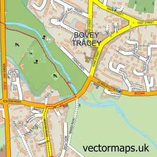
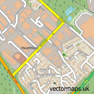
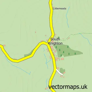
Nearby street map samples around Liverton Coldeast

More street maps in Devon
750 metre map area coverage
Boundary, postcode and point of interest information for the 750m x 750m rectangle centred on this sample map.
Boundaries containing map centre
Constituency: Central Devon Co Const
County: Devon County
District: Teignbridge District
Icb: NHS Devon ICB
Parish: Ilsington CP
Police Force: devon and cornwall
Postcode District: TQ12
Postcode Sector: TQ12 6
Ward: Haytor Ward
Nearby boundaries intersecting sample
No additional intersecting boundaries found.
Postcode coverage
POI category counts
Computer Wholesaler: 2
Pub: 2
Automotive: 1
Beauty Salon: 1
Business Equipment And Supply: 1
Convenience Store: 1
Flowers And Gifts Shop: 1
Gift Shop: 1
Home Cleaning: 1
Photo Booth Rental: 1
Sample points of interest
- Benedicts Bridge Garage
- MP Aesthetics
- Amazinkdirect
- JMV Solutions
- JMV Solutions
- Liverton Stores
- The Flower Kiosk Trago Mills Newton Abbott
- Magpies
- Knighton Cleaning Services
- Photo-Me
- Liverton Post Office
- The Star
Create a larger editable map of Liverton Coldeast
This sample shows only a 750 metre area. To create a larger map of Liverton Coldeast, use our map builder to choose your own coverage area, add titles and download editable SVG, PDF and PNG files.
Create a custom map of Liverton Coldeast