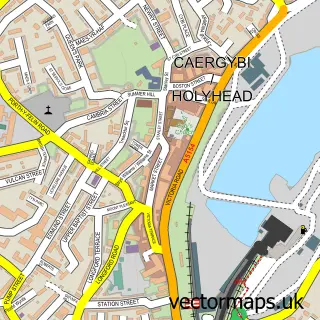
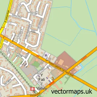
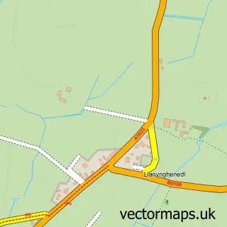
This Llaingoch street map is a detailed vector street map covering a 750m x 750m area. Select a larger area to create and download your own vector street map of Llaingoch.
The 750-metre map sample for Llaingoch covers 260 mapped buildings and approximately 11.7 km of road detail, of which 19 named roads are named. The immediate area includes 1 GP surgery within 2 miles and 3 MOT stations within 2 miles. The wider area around Llaingoch features 1 tourism point of interest and 2 campsites within 2 miles. To create a larger or custom map of Llaingoch, the map builder lets you define your own coverage area and download editable SVG, PDF and PNG files.
Create a larger editable map of Llaingoch
Choose any area you need and generate a high-quality vector map instantly. Perfect for print, planning, design, business and personal use.

This Llaingoch street map in Gwynedd is available as downloadable SVG, PDF and PNG map files, or as a printed map for planning, business, display, education, local information and design work. You can also create a larger custom map area using the map selector.
What this Llaingoch map sample shows
Llaingoch lies within Holyhead Community parish, part of Caergybi ward in the Sir Ynys Mon - Isle Of Anglesey local authority area. The postcode geography for this area includes the LL postcode area, the LL65 postcode district and the LL65 2 postcode sector. Residents fall under the Betsi Cadwaladr University Health Board for NHS services.
Local features near Llaingoch
Within 2 milesAmenities and services in and around Llaingoch.
Administrative and postcode information for Llaingoch
Llaingoch lies within Holyhead Community parish, part of Caergybi ward in the Sir Ynys Mon - Isle Of Anglesey local authority area. The postcode geography for this area includes the LL postcode area, the LL65 postcode district and the LL65 2 postcode sector. Residents fall under the Betsi Cadwaladr University Health Board for NHS services.
Nearby street map samples around Llaingoch

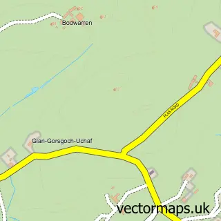
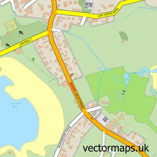
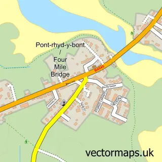
More street maps in Gwynedd
750 metre map area coverage
Boundary, postcode and point of interest information for the 750m x 750m rectangle centred on this sample map.
Boundaries containing map centre
Constituency: Ynys Mon Co Const
District: Sir Ynys Mon - Isle of Anglesey
Icb: Betsi Cadwaladr University
Parish: Holyhead Community
Police Force: north wales
Postcode District: LL65
Postcode Sector: LL65 1
Nearby boundaries intersecting sample
No additional intersecting boundaries found.
Postcode coverage
POI category counts
Beach: 1
Construction Services: 1
Educational Services: 1
Environmental Conservation Organization: 1
Holiday Rental Home: 1
Landmark And Historical Building: 1
Metal Supplier: 1
Professional Services: 1
Town Hall: 1
Sample points of interest
- Newry Beach
- Justin Taylor Brickworks
- Trinity Driving School
- Penucheldre Sheltered Housing
- Gorllas Getaway holiday let
- Caergybi Holyhead
- Grays Steel Fabrication
- Kiddyland Nursery Community Interest Co
- Llaingoch Village Hall
Create a larger editable map of Llaingoch
This sample shows only a 750 metre area. To create a larger map of Llaingoch, use our map builder to choose your own coverage area, add titles and download editable SVG, PDF and PNG files.
Create a custom map of Llaingoch