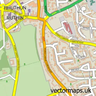
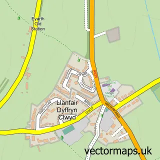
This Llanbedr Dyffryn Clwyd street map is a detailed vector street map covering a 750m x 750m area. Select a larger area to create and download your own vector street map of Llanbedr Dyffryn Clwyd.
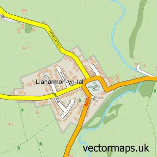
The 750-metre map sample for Llanbedr Dyffryn Clwyd covers 162 mapped buildings and approximately 10.6 km of road detail, of which 7 named roads are named. The immediate area includes 1 pub and 4 MOT stations within 2 miles. The wider area around Llanbedr Dyffryn Clwyd features 1 tourism point of interest and 1 food and drink venue. To create a larger or custom map of Llanbedr Dyffryn Clwyd, the map builder lets you define your own coverage area and download editable SVG, PDF and PNG files.
Create a larger editable map of Llanbedr Dyffryn Clwyd
Choose any area you need and generate a high-quality vector map instantly. Perfect for print, planning, design, business and personal use.

This Llanbedr Dyffryn Clwyd street map in Clwyd is available as downloadable SVG, PDF and PNG map files, or as a printed map for planning, business, display, education, local information and design work. You can also create a larger custom map area using the map selector.
What this Llanbedr Dyffryn Clwyd map sample shows
Llanbedr Dyffryn Clwyd lies within Llanbedr Dyffryn Clwyd Community parish, part of Llanbedr Dyffryn Clwyd/Llangynhafal ward in the Sir Ddinbych - Denbighshire local authority area. The postcode geography for this area includes the LL postcode area, the LL15 postcode district and the LL15 1 postcode sector. Residents fall under the Betsi Cadwaladr University Health Board for NHS services.
Local features near Llanbedr Dyffryn Clwyd
Within 2 milesAmenities and services in and around Llanbedr Dyffryn Clwyd.
Administrative and postcode information for Llanbedr Dyffryn Clwyd
Llanbedr Dyffryn Clwyd lies within Llanbedr Dyffryn Clwyd Community parish, part of Llanbedr Dyffryn Clwyd/Llangynhafal ward in the Sir Ddinbych - Denbighshire local authority area. The postcode geography for this area includes the LL postcode area, the LL15 postcode district and the LL15 1 postcode sector. Residents fall under the Betsi Cadwaladr University Health Board for NHS services.
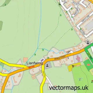
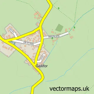
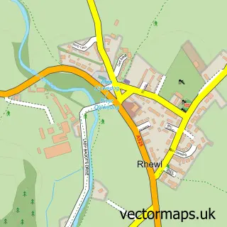
Nearby street map samples around Llanbedr Dyffryn Clwyd

More street maps in Clwyd
750 metre map area coverage
Boundary, postcode and point of interest information for the 750m x 750m rectangle centred on this sample map.
Boundaries containing map centre
Constituency: Clwyd East Co Const
District: Sir Ddinbych - Denbighshire
Icb: Betsi Cadwaladr University
Parish: Llanbedr Dyffryn Clwyd Community
Police Force: north wales
Postcode District: LL15
Postcode Sector: LL15 1
Nearby boundaries intersecting sample
No additional intersecting boundaries found.
Postcode coverage
POI category counts
Post Office: 3
Church Cathedral: 2
Information Technology Company: 2
Martial Arts Club: 2
Anglican Church: 1
Automotive Repair: 1
Gift Shop: 1
Jewelry Store: 1
Landmark And Historical Building: 1
Preschool: 1
Sample points of interest
- Dyffryn Clwyd North
- Aero Auto Repairs
- Old St. Peter's Church, Llanbedr Dyffryn Clwyd
- St Peter's Church
- Essar Aitch
- Comstat
- Comstat.uk
- AJJ Jewellers
- Llanbedr Dyffryn Clwyd
- Llanbedr DC Karate Club
- Taiji Online - Nei Gong And Yang Taijiquan
- Llanbedr DC Mobile Post Office
Create a larger editable map of Llanbedr Dyffryn Clwyd
This sample shows only a 750 metre area. To create a larger map of Llanbedr Dyffryn Clwyd, use our map builder to choose your own coverage area, add titles and download editable SVG, PDF and PNG files.
Create a custom map of Llanbedr Dyffryn Clwyd