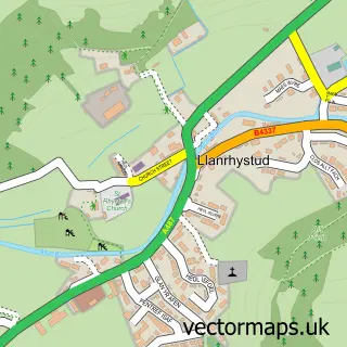
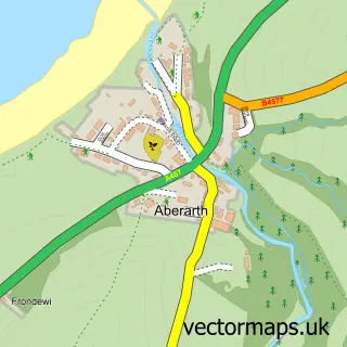
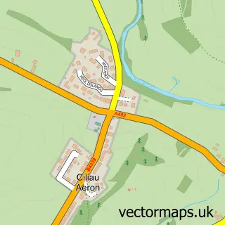
This Llanon street map is a detailed vector street map covering a 750m x 750m area. Select a larger area to create and download your own vector street map of Llanon.
The 750-metre map sample for Llanon covers 242 mapped buildings and approximately 9.9 km of road detail, of which 12 named roads are named. The immediate area includes 1 school, 1 pub and 1 MOT station within 2 miles. The wider area around Llanon features 2 tourism points of interest and 1 food and drink venue. To create a larger or custom map of Llanon, the map builder lets you define your own coverage area and download editable SVG, PDF and PNG files.
Create a larger editable map of Llanon
Choose any area you need and generate a high-quality vector map instantly. Perfect for print, planning, design, business and personal use.

This Llanon street map in Dyfed is available as downloadable SVG, PDF and PNG map files, or as a printed map for planning, business, display, education, local information and design work. You can also create a larger custom map area using the map selector.
What this Llanon map sample shows
Llanon lies within Llansantffraed Community parish, part of Llansantffraed ward in the Sir Ceredigion - Ceredigion local authority area. The postcode geography for this area includes the SY postcode area, the SY23 postcode district and the SY23 5 postcode sector. Residents fall under the Hywel Dda University Health Board for NHS services.
Local features near Llanon
Within 2 milesAmenities and services in and around Llanon.
Administrative and postcode information for Llanon
The local authority covering Llanon is Sir Ceredigion - Ceredigion, within the county of Dyfed. The settlement lies within Llansantffraed ward and Llansantffraed Community civil parish. The SY23 postcode district and SY23 5 postcode sector serve the immediate area. NHS provision in the area is delivered through Hywel Dda University Health Board.
Nearby street map samples around Llanon

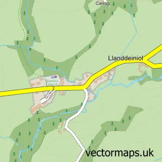
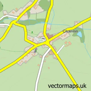
More street maps in Dyfed
750 metre map area coverage
Boundary, postcode and point of interest information for the 750m x 750m rectangle centred on this sample map.
Boundaries containing map centre
Constituency: Ceredigion Preseli Co Const
District: Sir Ceredigion - Ceredigion
Icb: Hywel Dda
Parish: Llansantffraed Community
Police Force: dyfed-powys
Postcode District: SY23
Postcode Sector: SY23 5
Nearby boundaries intersecting sample
No additional intersecting boundaries found.
Postcode coverage
POI category counts
Bed And Breakfast: 2
Butcher Shop: 2
Car Dealer: 2
Landmark And Historical Building: 2
Post Office: 2
Professional Services: 2
Carpenter: 1
Convenience Store: 1
Electrician: 1
Fast Food Restaurant: 1
Sample points of interest
- Brynarth Country Guest House
- Rose Villa
- Cigydd Sion Jones Butcher
- W B Evans Butchers
- Alan Hopkins Car Sales Ltd
- Lewis Motors Direct
- S.J.Roberts Carpentry/Joinery
- Premier Llanon
- Edwards Electrics
- Chip Box
- Llanon fish bar chip box 2
- Llanon School
Create a larger editable map of Llanon
This sample shows only a 750 metre area. To create a larger map of Llanon, use our map builder to choose your own coverage area, add titles and download editable SVG, PDF and PNG files.
Create a custom map of Llanon