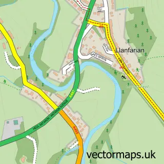
This Llanrhystud street map is a detailed vector street map covering a 750m x 750m area. Select a larger area to create and download your own vector street map of Llanrhystud.
The 750-metre map sample for Llanrhystud covers 192 mapped buildings and approximately 13.7 km of road detail, of which 9 named roads are named. The immediate area includes 1 school, 1 pub and 1 MOT station within 2 miles. The wider area around Llanrhystud features 1 tourism point of interest and 1 food and drink venue. To create a larger or custom map of Llanrhystud, the map builder lets you define your own coverage area and download editable SVG, PDF and PNG files.
Create a larger editable map of Llanrhystud
Choose any area you need and generate a high-quality vector map instantly. Perfect for print, planning, design, business and personal use.

This Llanrhystud street map in Dyfed is available as downloadable SVG, PDF and PNG map files, or as a printed map for planning, business, display, education, local information and design work. You can also create a larger custom map area using the map selector.
What this Llanrhystud map sample shows
Llanrhystud lies within Llanrhystyd Community parish, part of Llanrhystyd ward in the Sir Ceredigion - Ceredigion local authority area. The postcode geography for this area includes the SY postcode area, the SY23 postcode district and the SY23 5 postcode sector. Residents fall under the Hywel Dda University Health Board for NHS services.
Local features near Llanrhystud
Within 2 milesAmenities and services in and around Llanrhystud.
Administrative and postcode information for Llanrhystud
Llanrhystud lies within Llanrhystyd Community parish, part of Llanrhystyd ward in the Sir Ceredigion - Ceredigion local authority area. The postcode geography for this area includes the SY postcode area, the SY23 postcode district and the SY23 5 postcode sector. Residents fall under the Hywel Dda University Health Board for NHS services.
Nearby street map samples around Llanrhystud

More street maps in Dyfed
750 metre map area coverage
Boundary, postcode and point of interest information for the 750m x 750m rectangle centred on this sample map.
Boundaries containing map centre
Constituency: Ceredigion Preseli Co Const
District: Sir Ceredigion - Ceredigion
Icb: Hywel Dda
Parish: Llanrhystyd Community
Police Force: dyfed-powys
Postcode District: SY23
Postcode Sector: SY23 5
Nearby boundaries intersecting sample
No additional intersecting boundaries found.
Postcode coverage
POI category counts
Electrician: 3
Gas Station: 3
Furniture Store: 2
Automotive Repair: 1
Beauty Salon: 1
Bed And Breakfast: 1
Community Center: 1
Contractor: 1
Convenience Store: 1
Energy Equipment And Solution: 1
Sample points of interest
- L S Commercials
- The Style Box
- Sgubor Wyre Bed and Breakfast
- Neuadd Goffa Llanrhystud Memorial Hall
- Spray Rend Plus
- Costcutter
- Chris M Randall
- JER Pugh
- Roger Pugh Electrical Contractor
- Sunlabob Renewable Energy
- Blodau'R Bedol
- MGW Discount Store
Create a larger editable map of Llanrhystud
This sample shows only a 750 metre area. To create a larger map of Llanrhystud, use our map builder to choose your own coverage area, add titles and download editable SVG, PDF and PNG files.
Create a custom map of Llanrhystud