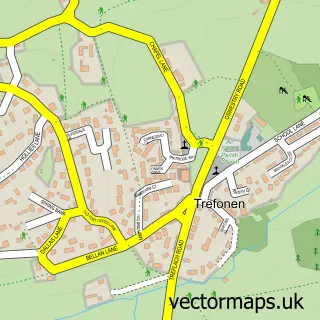
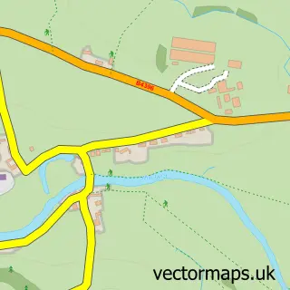
This Llansilin street map is a detailed vector street map covering a 750m x 750m area. Select a larger area to create and download your own vector street map of Llansilin.
The 750-metre map sample for Llansilin covers 93 mapped buildings and approximately 9.3 km of road detail, of which 3 named roads are named. The immediate area includes 1 school, 1 pub and 1 MOT station. The wider area around Llansilin features 1 food and drink venue and 1 campsite within 2 miles. To create a larger or custom map of Llansilin, the map builder lets you define your own coverage area and download editable SVG, PDF and PNG files.
Create a larger editable map of Llansilin
Choose any area you need and generate a high-quality vector map instantly. Perfect for print, planning, design, business and personal use.

This Llansilin street map in Powys is available as downloadable SVG, PDF and PNG map files, or as a printed map for planning, business, display, education, local information and design work. You can also create a larger custom map area using the map selector.
What this Llansilin map sample shows
Llansilin lies within Llansilin Community parish, part of Llanrhaeadr-Ym-Mochnant/Llansilin ward in the Powys - Powys local authority area. The postcode geography for this area includes the SY postcode area, the SY10 postcode district and the SY10 7 postcode sector. Residents fall under the Powys Teaching Health Board for NHS services.
Local features near Llansilin
Within 2 milesAmenities and services in and around Llansilin.
Administrative and postcode information for Llansilin
Llansilin lies within Llansilin Community parish, part of Llanrhaeadr-Ym-Mochnant/Llansilin ward in the Powys - Powys local authority area. The postcode geography for this area includes the SY postcode area, the SY10 postcode district and the SY10 7 postcode sector. Residents fall under the Powys Teaching Health Board for NHS services.
Nearby street map samples around Llansilin

More street maps in Powys
750 metre map area coverage
Boundary, postcode and point of interest information for the 750m x 750m rectangle centred on this sample map.
Boundaries containing map centre
Constituency: Montgomeryshire and Glyndwr Co Const
District: Powys - Powys
Icb: Powys Teaching
Parish: Llansilin Community
Police Force: dyfed-powys
Postcode District: SY10
Postcode Sector: SY10 7
Nearby boundaries intersecting sample
No additional intersecting boundaries found.
Postcode coverage
POI category counts
Post Office: 2
Automotive Dealer: 1
Building Supply Store: 1
Church Cathedral: 1
Land Surveying: 1
Pub: 1
Sample points of interest
- D M EVANS 4X4 + Atv
- Window Fresh
- St Silin's Church
- SJM Surveyors
- Llansilin Post Office
- Post Office Ltd.
- The Wynnstay Inn
Create a larger editable map of Llansilin
This sample shows only a 750 metre area. To create a larger map of Llansilin, use our map builder to choose your own coverage area, add titles and download editable SVG, PDF and PNG files.
Create a custom map of Llansilin