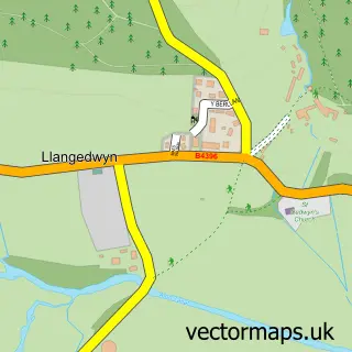
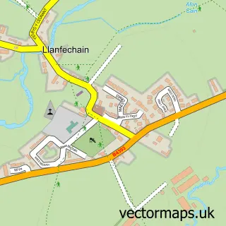
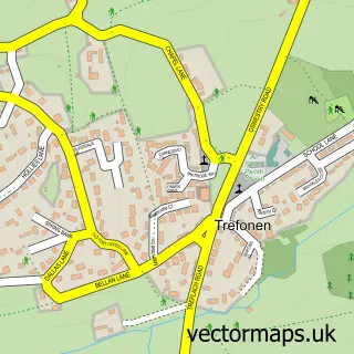
This Pen-y-bont Llannerch Emrys street map is a detailed vector street map covering a 750m x 750m area. Select a larger area to create and download your own vector street map of Pen-y-bont Llannerch Emrys.
The 750-metre map sample for Pen-y-bont Llannerch Emrys covers 45 mapped buildings and approximately 7.4 km of road detail, of which 1 named road are named. The immediate area includes 1 pub. The wider area around Pen-y-bont Llannerch Emrys features 1 food and drink venue. To create a larger or custom map of Pen-y-bont Llannerch Emrys, the map builder lets you define your own coverage area and download editable SVG, PDF and PNG files.
Create a larger editable map of Pen-y-bont Llannerch Emrys
Choose any area you need and generate a high-quality vector map instantly. Perfect for print, planning, design, business and personal use.

This Pen-y-bont Llannerch Emrys street map in Powys is available as downloadable SVG, PDF and PNG map files, or as a printed map for planning, business, display, education, local information and design work. You can also create a larger custom map area using the map selector.
What this Pen-y-bont Llannerch Emrys map sample shows
Pen-y-bont Llannerch Emrys lies within Llangedwyn Community parish, part of Llanrhaeadr-Ym-Mochnant/Llansilin ward in the Powys - Powys local authority area. The postcode geography for this area includes the SY postcode area, the SY10 postcode district and the SY10 9 postcode sector. Residents fall under the Powys Teaching Health Board for NHS services.
Local features near Pen-y-bont Llannerch Emrys
Within 2 milesAmenities and services in and around Pen-y-bont Llannerch Emrys.
Administrative and postcode information for Pen-y-bont Llannerch Emrys
The local authority covering Pen-y-bont Llannerch Emrys is Powys - Powys, within the county of Powys. The settlement lies within Llanrhaeadr-Ym-Mochnant/Llansilin ward and Llangedwyn Community civil parish. The SY10 postcode district and SY10 9 postcode sector serve the immediate area. NHS provision in the area is delivered through Powys Teaching Health Board.
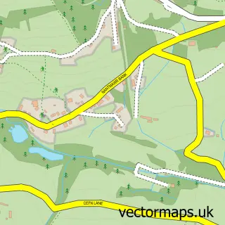
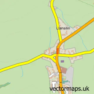
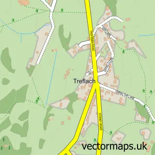
Nearby street map samples around Pen-y-bont Llannerch Emrys

More street maps in Powys
750 metre map area coverage
Boundary, postcode and point of interest information for the 750m x 750m rectangle centred on this sample map.
Boundaries containing map centre
Constituency: Montgomeryshire and Glyndwr Co Const
District: Powys - Powys
Icb: Powys Teaching
Parish: Llangedwyn Community
Police Force: dyfed-powys
Postcode District: SY10
Postcode Sector: SY10 9
Nearby boundaries intersecting sample
Constituency: North Shropshire Co Const
District: Shropshire
Icb: NHS Shropshire Telford and Wrekin ICB
Parish: Llansantffraid Community, Llanyblodwel CP
Police Force: west mercia
Postcode coverage
POI category counts
Business Consulting: 1
Grocery Store: 1
Pub: 1
Stone Supplier: 1
Train Station: 1
Sample points of interest
- JGD Projects
- Beth Bakes
- Penybont Inn
- Powys & Marches Stone Supplies
- Llansilin Road railway station
Create a larger editable map of Pen-y-bont Llannerch Emrys
This sample shows only a 750 metre area. To create a larger map of Pen-y-bont Llannerch Emrys, use our map builder to choose your own coverage area, add titles and download editable SVG, PDF and PNG files.
Create a custom map of Pen-y-bont Llannerch Emrys