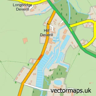
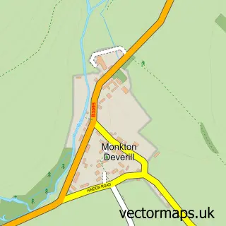
This Longbridge Deverill street map is a detailed vector street map covering a 750m x 750m area. Select a larger area to create and download your own vector street map of Longbridge Deverill.
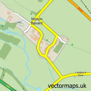
The 750-metre map sample for Longbridge Deverill covers 124 mapped buildings and approximately 10.1 km of road detail, of which 5 named roads are named. The immediate area includes 1 MOT station within 2 miles. The wider area around Longbridge Deverill features 1 hotel and 2 campsites within 2 miles. To create a larger or custom map of Longbridge Deverill, the map builder lets you define your own coverage area and download editable SVG, PDF and PNG files.
Create a larger editable map of Longbridge Deverill
Choose any area you need and generate a high-quality vector map instantly. Perfect for print, planning, design, business and personal use.

This Longbridge Deverill street map in Wiltshire is available as downloadable SVG, PDF and PNG map files, or as a printed map for planning, business, display, education, local information and design work. You can also create a larger custom map area using the map selector.
What this Longbridge Deverill map sample shows
Longbridge Deverill lies within Longbridge Deverill Cp parish, part of Warminster Without ward in the Wiltshire local authority area. The postcode geography for this area includes the BA postcode area, the BA12 postcode district and the BA12 7 postcode sector. Residents fall under the Nhs Bath And North East Somerset, Swindon And Wiltshire Integrated Care Board for NHS services.
Local features near Longbridge Deverill
Within 2 milesAmenities and services in and around Longbridge Deverill.
Administrative and postcode information for Longbridge Deverill
Longbridge Deverill lies within Longbridge Deverill Cp parish, part of Warminster Without ward in the Wiltshire local authority area. The postcode geography for this area includes the BA postcode area, the BA12 postcode district and the BA12 7 postcode sector. Residents fall under the Nhs Bath And North East Somerset, Swindon And Wiltshire Integrated Care Board for NHS services.
Nearby street map samples around Longbridge Deverill

More street maps in Wiltshire
750 metre map area coverage
Boundary, postcode and point of interest information for the 750m x 750m rectangle centred on this sample map.
Boundaries containing map centre
Constituency: South West Wiltshire Co Const
District: Wiltshire
Icb: NHS Bath and North East Somerset Swindon and Wiltshire ICB
Parish: Longbridge Deverill CP
Police Force: wiltshire
Postcode District: BA12
Postcode Sector: BA12 7
Nearby boundaries intersecting sample
No additional intersecting boundaries found.
Postcode coverage
POI category counts
Assisted Living Facility: 2
Convenience Store: 2
Korean Grocery Store: 2
Atms: 1
Automotive Services And Repair: 1
Beverage Store: 1
Education: 1
Hotel: 1
Metal Fabricator: 1
Professional Services: 1
Sample points of interest
- Longbridge Deverill Nursing Home
- Wessex College
- SGN LTD - Longbridge Deverill Service Station (Rusdene)
- InstaVolt
- The George Inn
- Londis ESSENTIALS LONGBRIDGE
- Longbridge Deverill Service Station and Vape Store
- BRICK Robot Club
- George Inn
- BP
- BP
- Bean Metalworks
Create a larger editable map of Longbridge Deverill
This sample shows only a 750 metre area. To create a larger map of Longbridge Deverill, use our map builder to choose your own coverage area, add titles and download editable SVG, PDF and PNG files.
Create a custom map of Longbridge Deverill