Vector Maps logo
Home Why it works Popular maps Districts Samples Customizer Create Your Map
VectorMaps.uk
Home Popular maps Districts Samples Customizer Create Your Map Privacy Disclaimer
Home / UK Maps / Dunbartonshire / Luss Map

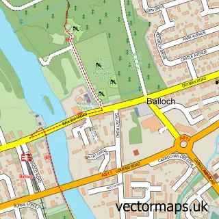
This Luss street map is a detailed vector street map covering a 750m x 750m area. Select a larger area to create and download your own vector street map of Luss.

Luss is a village in Dunbartonshire, in the West Scotland of Scotland. The settlement falls within the Argyll And Bute parliamentary constituency. It is served by the G83 postcode district, with G83 8 as the local postcode sector.

The 750-metre map sample for Luss covers 76 mapped buildings and approximately 16.0 km of road detail, of which 2 named roads are named. The wider area around Luss features 2 tourism points of interest, 5 food and drink venues and 4 hotels. To create a larger or custom map of Luss, the map builder lets you define your own coverage area and download editable SVG, PDF and PNG files.

76Buildings
15.95 kmRoads
2Named roads
0Residents within 2 miles
Create your own

Create a larger editable map of Luss

Choose any area you need and generate a high-quality vector map instantly. Perfect for print, planning, design, business and personal use.

Choose any location
Editable SVG files
Any size up to A0
PDF, PNG & more
Instant download
High quality guaranteed
Create My Custom Map
Secure, private & no credit card required
Luss Vector Street Map
750m Sample
Luss vector street map sample showing roads, buildings and local features in a 750 metre preview area
Buy Luss Map Print from £12.95 Buy Luss Digital Map from £6

This Luss street map in Dunbartonshire is available as downloadable SVG, PDF and PNG map files, or as a printed map for planning, business, display, education, local information and design work. You can also create a larger custom map area using the map selector.

What this Luss map sample shows

Luss lies within Argyll And Bute parish, part of Lomond North ward in the Argyll And Bute local authority area. The postcode geography for this area includes the G postcode area, the G83 postcode district and the G83 8 postcode sector. Residents fall under the Highland for NHS services.

Local features near Luss

Within 2 miles

Amenities and services in and around Luss.

2 Tourism & leisure
5 Food & drink
4 Hotels
1 Vehicle services

Counts are approximate and based on publicly available data.

Administrative and postcode information for Luss

The local authority covering Luss is Argyll And Bute, within the county of Dunbartonshire. The settlement lies within Lomond North ward and Argyll And Bute civil parish. The G83 postcode district and G83 8 postcode sector serve the immediate area. NHS provision in the area is delivered through Highland.

Parish ARGYLL AND BUTE
Ward Lomond North
District / local authority Argyll and Bute
County Dunbartonshire
Historic county Dunbartonshire
Postcode district G83
Postcode sector G83 8
Parliamentary constituency Argyll and Bute
Region West Scotland
Country Scotland

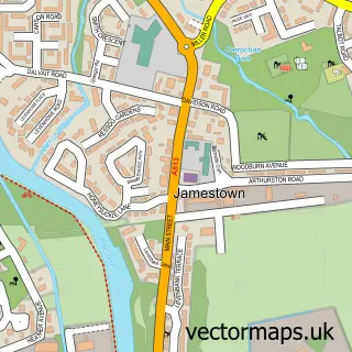
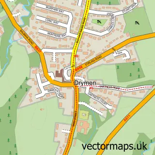
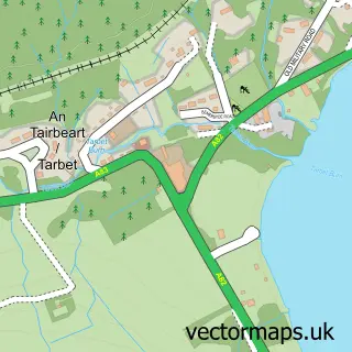
Nearby street map samples around Luss

Street map sample of Balloch, Dunbartonshire Balloch Town - Dunbartonshire - 7.1 miles Street map sample of Glasgow, City of Glasgow Glasgow City - City of Glasgow - 22.4 miles Street map sample of Balmaha, Stirling and Falkirk Balmaha Village - Stirling and Falkirk - 4.0 miles Street map sample of Milton of Buchanan, Stirling and Falkirk Milton of Buchanan Village - Stirling and Falkirk - 5.5 miles Street map sample of Gartocharn, Dunbartonshire Gartocharn Village - Dunbartonshire - 5.9 miles Street map sample of Garelochhead, Dunbartonshire Garelochhead Village - Dunbartonshire - 7.5 miles Street map sample of Jamestown, Dunbartonshire Jamestown Village - Dunbartonshire - 7.6 miles Street map sample of Drymen, Stirling and Falkirk Drymen Village - Stirling and Falkirk - 7.6 miles Street map sample of Tarbet, Dunbartonshire Tarbet Village - Dunbartonshire - 7.6 miles Street map sample of Shandon, Dunbartonshire Shandon Village - Dunbartonshire - 7.7 miles

More street maps in Dunbartonshire

Street map sample of Gartocharn, Dunbartonshire Gartocharn Village - 5.9 miles Street map sample of Balloch, Dunbartonshire Balloch Town - 7.1 miles Street map sample of Garelochhead, Dunbartonshire Garelochhead Village - 7.5 miles Street map sample of Jamestown, Dunbartonshire Jamestown Village - 7.6 miles Street map sample of Tarbet, Dunbartonshire Tarbet Village - 7.6 miles

750 metre map area coverage

Boundary, postcode and point of interest information for the 750m x 750m rectangle centred on this sample map.

Boundaries containing map centre

Constituency: Argyll, Bute and South Lochaber Co Const

District: Argyll and Bute

Icb: Highland

Postcode District: G83

Postcode Sector: G83 8

Ward: Lomond North Ward

Nearby boundaries intersecting sample

Postcode District: G63

Postcode Sector: G63 0

Postcode coverage

G83 G83 8 G63 G63 0

POI category counts

Bed And Breakfast: 5

Hotel: 4

Active Life: 3

Restaurant: 3

Community Services Non Profits: 2

Cottage: 2

Flowers And Gifts Shop: 2

Gift Shop: 2

Hiking Trail: 2

Shipping Center: 2

Sample points of interest

  • Loch Lomond Adventures Active Life
  • Loch Lomond Tours Active Life
  • Luss Activity Hub Active Life
  • 4x4 Adventures Scotland Attractions And Activities
  • Luss Beach Beach
  • Alderdale B&B Bed And Breakfast
  • Crescent Cottage Bed And Breakfast
  • Glenview Bed And Breakfast
  • Global Bed & Breakfast Bed And Breakfast
  • Shegarton Farm Cottages,Loch Lomond Bed And Breakfast
  • Loch Lomond Leisure Boat Rental And Training
  • Beau Jangles Boat Tours

Create a larger editable map of Luss

This sample shows only a 750 metre area. To create a larger map of Luss, use our map builder to choose your own coverage area, add titles and download editable SVG, PDF and PNG files.

Create a custom map of Luss

Phone 01751 473136 | Copyright Vectormaps.uk 2026

Samples Customizer Privacy Disclaimer
Luss Vector Street Map
Luss enlarged street map sample showing a 750 metre preview area