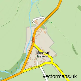
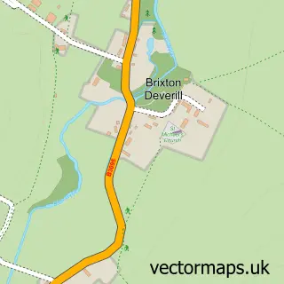
This Maiden Bradley street map is a detailed vector street map covering a 750m x 750m area. Select a larger area to create and download your own vector street map of Maiden Bradley.
The 750-metre map sample for Maiden Bradley covers 103 mapped buildings and approximately 10.0 km of road detail, of which 7 named roads are named. The immediate area includes 1 pub. The wider area around Maiden Bradley features 2 food and drink venues. To create a larger or custom map of Maiden Bradley, the map builder lets you define your own coverage area and download editable SVG, PDF and PNG files.
Create a larger editable map of Maiden Bradley
Choose any area you need and generate a high-quality vector map instantly. Perfect for print, planning, design, business and personal use.

This Maiden Bradley street map in Wiltshire is available as downloadable SVG, PDF and PNG map files, or as a printed map for planning, business, display, education, local information and design work. You can also create a larger custom map area using the map selector.
What this Maiden Bradley map sample shows
Maiden Bradley lies within Maiden Bradley With Yarnfield Cp parish, part of Warminster Without ward in the Wiltshire local authority area. The postcode geography for this area includes the BA postcode area, the BA12 postcode district and the BA12 7 postcode sector. Residents fall under the Nhs Bath And North East Somerset, Swindon And Wiltshire Integrated Care Board for NHS services.
Local features near Maiden Bradley
Within 2 milesAmenities and services in and around Maiden Bradley.
Administrative and postcode information for Maiden Bradley
Maiden Bradley lies within Maiden Bradley With Yarnfield Cp parish, part of Warminster Without ward in the Wiltshire local authority area. The postcode geography for this area includes the BA postcode area, the BA12 postcode district and the BA12 7 postcode sector. Residents fall under the Nhs Bath And North East Somerset, Swindon And Wiltshire Integrated Care Board for NHS services.
Nearby street map samples around Maiden Bradley

More street maps in Wiltshire
750 metre map area coverage
Boundary, postcode and point of interest information for the 750m x 750m rectangle centred on this sample map.
Boundaries containing map centre
Constituency: South West Wiltshire Co Const
District: Wiltshire
Icb: NHS Bath and North East Somerset Swindon and Wiltshire ICB
Parish: Maiden Bradley with Yarnfield CP
Police Force: wiltshire
Postcode District: BA12
Postcode Sector: BA12 7
Nearby boundaries intersecting sample
No additional intersecting boundaries found.
Postcode coverage
POI category counts
Anglican Church: 1
Beauty Salon: 1
Building Supply Store: 1
Business Management Services: 1
Coffee Shop: 1
Community Center: 1
Event Planning: 1
Gastropub: 1
Hardware Store: 1
Pest Control Service: 1
Sample points of interest
- Maiden Bradley: All Saints
- The Potting Shed
- Sydenhams Timber Centre Maiden Bradley
- Only French Tuition
- The Bradley Pantry
- Maiden Bradley Memorial Hall
- Bradley House
- Somerset Arms
- Greenlife Plumbing Ltd
- Westcountry Environmental Services
- Maiden Bradley Post Office
- Dean Press
Create a larger editable map of Maiden Bradley
This sample shows only a 750 metre area. To create a larger map of Maiden Bradley, use our map builder to choose your own coverage area, add titles and download editable SVG, PDF and PNG files.
Create a custom map of Maiden Bradley