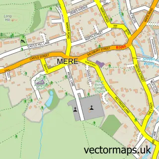
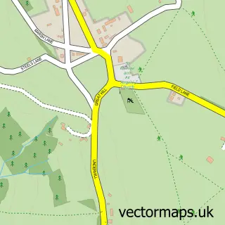
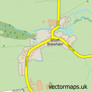
This Stourton street map is a detailed vector street map covering a 750m x 750m area. Select a larger area to create and download your own vector street map of Stourton.
The 750-metre map sample for Stourton covers 24 mapped buildings and approximately 6.5 km of road detail, of which 1 named road are named. The immediate area includes 2 pubs and 4 MOT stations within 2 miles. The wider area around Stourton features 2 food and drink venues and 1 hotel. To create a larger or custom map of Stourton, the map builder lets you define your own coverage area and download editable SVG, PDF and PNG files.
Create a larger editable map of Stourton
Choose any area you need and generate a high-quality vector map instantly. Perfect for print, planning, design, business and personal use.

This Stourton street map in Wiltshire is available as downloadable SVG, PDF and PNG map files, or as a printed map for planning, business, display, education, local information and design work. You can also create a larger custom map area using the map selector.
What this Stourton map sample shows
Stourton lies within Stourton With Gasper Cp parish, part of Mere ward in the Wiltshire local authority area. The postcode geography for this area includes the BA postcode area, the BA12 postcode district and the BA12 6 postcode sector. Residents fall under the Nhs Bath And North East Somerset, Swindon And Wiltshire Integrated Care Board for NHS services.
Local features near Stourton
Within 2 milesAmenities and services in and around Stourton.
Administrative and postcode information for Stourton
The local authority covering Stourton is Wiltshire, within the county of Wiltshire. The settlement lies within Mere ward and Stourton With Gasper Cp civil parish. The BA12 postcode district and BA12 6 postcode sector serve the immediate area. NHS provision in the area is delivered through Salisbury Nhs Foundation Trust.
Nearby street map samples around Stourton

More street maps in Wiltshire
750 metre map area coverage
Boundary, postcode and point of interest information for the 750m x 750m rectangle centred on this sample map.
Boundaries containing map centre
Constituency: South West Wiltshire Co Const
District: Wiltshire
Icb: NHS Bath and North East Somerset Swindon and Wiltshire ICB
Parish: Stourton with Gasper CP
Police Force: wiltshire
Postcode District: BA12
Postcode Sector: BA12 6
Nearby boundaries intersecting sample
No additional intersecting boundaries found.
Postcode coverage
POI category counts
Ice Cream Shop: 2
Pub: 2
Active Life: 1
Anglican Church: 1
Antique Store: 1
Art Gallery: 1
Business To Business: 1
Historical Tours: 1
Hotel: 1
Landscape Architect: 1
Sample points of interest
- Stourhead Gardens
- Stourton: Saint Peter
- Stourhead Antique & Vintage Fair.
- First-View
- The Better Picture
- Stourhead Stableyard
- Stourhead Gardens Bed & Breakfast
- Temple of Refreshment
- The Ice-cream Parlour
- Fi Boyle Garden Design
- Bristol High Cross
- Spread Eagle Inn
Create a larger editable map of Stourton
This sample shows only a 750 metre area. To create a larger map of Stourton, use our map builder to choose your own coverage area, add titles and download editable SVG, PDF and PNG files.
Create a custom map of Stourton