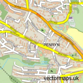
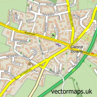
This Malpas street map is a detailed vector street map covering a 750m x 750m area. Select a larger area to create and download your own vector street map of Malpas.
The 750-metre map sample for Malpas covers 66 mapped buildings and approximately 5.8 km of road detail, of which 2 named roads are named. The immediate area includes 3 GP surgeries within 2 miles and 5 MOT stations within 2 miles. The wider area around Malpas features 1 tourism point of interest and 2 food and drink venues. To create a larger or custom map of Malpas, the map builder lets you define your own coverage area and download editable SVG, PDF and PNG files.
Create a larger editable map of Malpas
Choose any area you need and generate a high-quality vector map instantly. Perfect for print, planning, design, business and personal use.

This Malpas street map in Cornwall is available as downloadable SVG, PDF and PNG map files, or as a printed map for planning, business, display, education, local information and design work. You can also create a larger custom map area using the map selector.
What this Malpas map sample shows
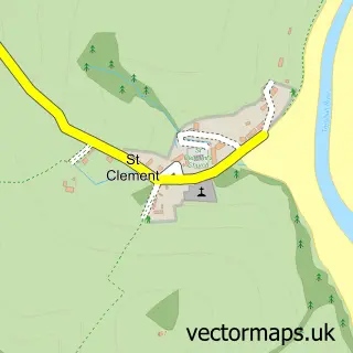
Malpas lies within St. Clement Cp parish, part of Ladock, St Clement And St Erme ward in the Cornwall local authority area. The postcode geography for this area includes the TR postcode area, the TR1 postcode district and the TR1 1 postcode sector. Residents fall under the Nhs Cornwall And The Isles Of Scilly Integrated Care Board for NHS services.
Local features near Malpas
Within 2 milesAmenities and services in and around Malpas.
Administrative and postcode information for Malpas
The local authority covering Malpas is Cornwall, within the county of Cornwall. The settlement lies within Ladock, St Clement And St Erme ward and St. Clement Cp civil parish. The TR1 postcode district and TR1 1 postcode sector serve the immediate area. NHS services are coordinated through the Nhs Cornwall And The Isles Of Scilly Integrated Care Board.
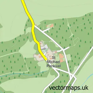
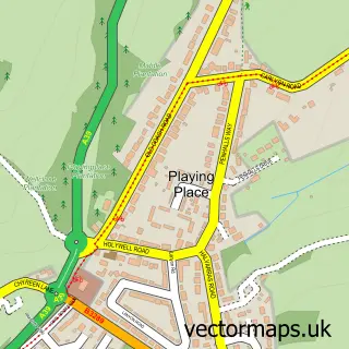
Nearby street map samples around Malpas

More street maps in Cornwall
750 metre map area coverage
Boundary, postcode and point of interest information for the 750m x 750m rectangle centred on this sample map.
Boundaries containing map centre
Constituency: Truro and Falmouth Co Const
District: Cornwall
Icb: NHS Cornwall and the Isles of Scilly ICB
Parish: St. Clement CP
Police Force: devon and cornwall
Postcode District: TR1
Postcode Sector: TR1 1
Nearby boundaries intersecting sample
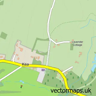
Parish: Kea CP, St. Michael Penkevil CP
Postcode District: TR2, TR3
Postcode Sector: TR2 4, TR3 6
Postcode coverage
POI category counts
Coffee Shop: 2
Anglican Church: 1
Arts And Entertainment: 1
Boat Rental And Training: 1
Campground: 1
Community Center: 1
Furniture Assembly: 1
Gastropub: 1
Holiday Rental Home: 1
Private Association: 1
Sample points of interest
- Malpas: St Andrew
- Malpas Marine
- Sailing Barge Drifter
- Camp Kernow
- Heron Farm & Coffee Shop
- Heron Inn Farm&Coffee Shop
- Malpas Village Hall
- Stitched & Stuffed
- Heron Inn
- Waterside Holiday Cottages
- Kabin
- Oysters Cottage Malpas
Create a larger editable map of Malpas
This sample shows only a 750 metre area. To create a larger map of Malpas, use our map builder to choose your own coverage area, add titles and download editable SVG, PDF and PNG files.
Create a custom map of Malpas