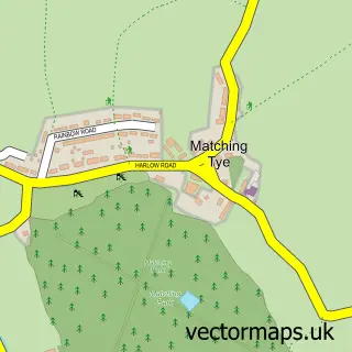
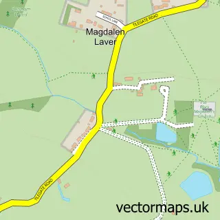
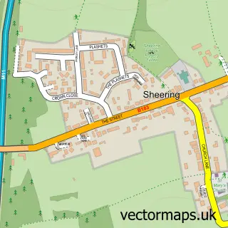
This Matching Green street map is a detailed vector street map covering a 750m x 750m area. Select a larger area to create and download your own vector street map of Matching Green.
The 750-metre map sample for Matching Green covers 162 mapped buildings and approximately 17.1 km of road detail, of which 6 named roads are named. The immediate area includes 1 school, 1 pub and 1 MOT station within 2 miles. The wider area around Matching Green features 1 food and drink venue. To create a larger or custom map of Matching Green, the map builder lets you define your own coverage area and download editable SVG, PDF and PNG files.
Create a larger editable map of Matching Green
Choose any area you need and generate a high-quality vector map instantly. Perfect for print, planning, design, business and personal use.

This Matching Green street map in Essex is available as downloadable SVG, PDF and PNG map files, or as a printed map for planning, business, display, education, local information and design work. You can also create a larger custom map area using the map selector.
What this Matching Green map sample shows
Matching Green lies within Matching Cp parish, part of Hastingwood, Matching And Sheering Village ward in the Epping Forest District local authority area. The postcode geography for this area includes the CM postcode area, the CM17 postcode district and the CM17 0 postcode sector. Residents fall under the Nhs Hertfordshire And West Essex Integrated Care Board for NHS services.
Local features near Matching Green
Within 2 milesAmenities and services in and around Matching Green.
Administrative and postcode information for Matching Green
Matching Green lies within Matching Cp parish, part of Hastingwood, Matching And Sheering Village ward in the Epping Forest District local authority area. The postcode geography for this area includes the CM postcode area, the CM17 postcode district and the CM17 0 postcode sector. Residents fall under the Nhs Hertfordshire And West Essex Integrated Care Board for NHS services.
Nearby street map samples around Matching Green

More street maps in Essex
750 metre map area coverage
Boundary, postcode and point of interest information for the 750m x 750m rectangle centred on this sample map.
Boundaries containing map centre
Constituency: Harlow Co Const
County: Essex County
District: Epping Forest District
Icb: NHS Central East ICB
Parish: Matching CP
Police Force: essex
Postcode District: CM17
Postcode Sector: CM17 0
Ward: Rural East Ward
Nearby boundaries intersecting sample
Constituency: Brentwood and Ongar Co Const
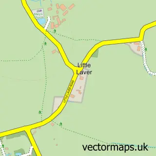
Parish: High Laver CP, Little Laver CP
Postcode coverage
POI category counts
Elementary School: 2
Arts And Crafts: 1
Automotive Repair: 1
Childrens Clothing Store: 1
Montessori School: 1
Pub: 1
School: 1
Sports Club And League: 1
Sample points of interest
- R S Screen
- Grasmere Garage
- A Holland
- Fidgety Feet
- Matching Green Church of England Primary School
- St. Edmund's Montessori
- The Chequers Matching Green
- Graffham Consulting Ltd
- Matching Green Cricket Club
Create a larger editable map of Matching Green
This sample shows only a 750 metre area. To create a larger map of Matching Green, use our map builder to choose your own coverage area, add titles and download editable SVG, PDF and PNG files.
Create a custom map of Matching Green