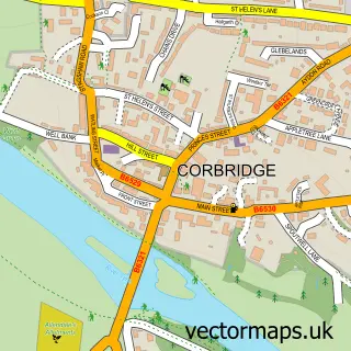
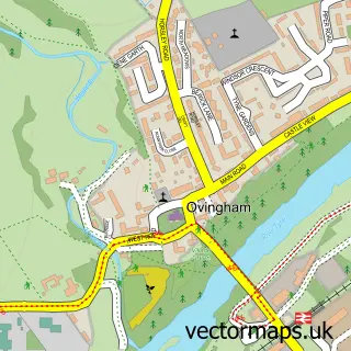
This Matfen street map is a detailed vector street map covering a 750m x 750m area. Select a larger area to create and download your own vector street map of Matfen.
The 750-metre map sample for Matfen covers 68 mapped buildings and approximately 12.9 km of road detail, of which 3 named roads are named. The immediate area includes 1 pub. The wider area around Matfen features 1 tourism point of interest, 3 food and drink venues and 2 hotels. To create a larger or custom map of Matfen, the map builder lets you define your own coverage area and download editable SVG, PDF and PNG files.
Create a larger editable map of Matfen
Choose any area you need and generate a high-quality vector map instantly. Perfect for print, planning, design, business and personal use.

This Matfen street map in Northumberland is available as downloadable SVG, PDF and PNG map files, or as a printed map for planning, business, display, education, local information and design work. You can also create a larger custom map area using the map selector.
What this Matfen map sample shows
Matfen lies within Matfen Cp parish, part of Ponteland West ward in the Northumberland local authority area. The postcode geography for this area includes the NE postcode area, the NE20 postcode district and the NE20 0 postcode sector. Residents fall under the Nhs North East And North Cumbria Integrated Care Board for NHS services.
Local features near Matfen
Within 2 milesAmenities and services in and around Matfen.
Administrative and postcode information for Matfen
Matfen lies within Matfen Cp parish, part of Ponteland West ward in the Northumberland local authority area. The postcode geography for this area includes the NE postcode area, the NE20 postcode district and the NE20 0 postcode sector. Residents fall under the Nhs North East And North Cumbria Integrated Care Board for NHS services.
Nearby street map samples around Matfen

More street maps in Northumberland
750 metre map area coverage
Boundary, postcode and point of interest information for the 750m x 750m rectangle centred on this sample map.
Boundaries containing map centre
Constituency: Hexham Co Const
District: Northumberland
Icb: NHS North East and North Cumbria ICB
Parish: Matfen CP
Police Force: northumberland
Postcode District: NE20
Postcode Sector: NE20 0
Nearby boundaries intersecting sample
No additional intersecting boundaries found.
Postcode coverage
POI category counts
Coffee Shop: 2
Hotel: 2
Active Life: 1
Advertising Agency: 1
Church Cathedral: 1
Golf Course: 1
Holiday Rental Home: 1
Landmark And Historical Building: 1
Library: 1
Pest Control Service: 1
Sample points of interest
- Go Ape Matfen
- Raring2go Northumberland
- Holy Trinity Church
- Dulcissima coffee house and deli
- Matfen Village Store and Coffee Shop
- Academy Golf Within Maften Hall Golf Club
- Matfen Annexe
- Matfen Hall
- The Keepers
- Fenwick Tower (Northumberland)
- Library and Print Room Restaurant at Matfen Hall
- G S Environmental
Create a larger editable map of Matfen
This sample shows only a 750 metre area. To create a larger map of Matfen, use our map builder to choose your own coverage area, add titles and download editable SVG, PDF and PNG files.
Create a custom map of Matfen