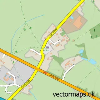
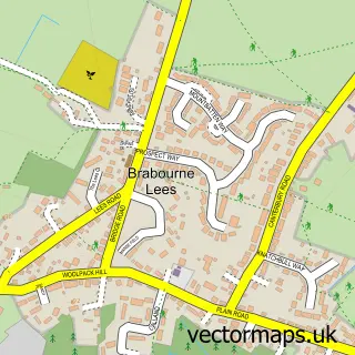
This Mersham street map is a detailed vector street map covering a 750m x 750m area. Select a larger area to create and download your own vector street map of Mersham.
The 750-metre map sample for Mersham covers 295 mapped buildings and approximately 8.2 km of road detail, of which 11 named roads are named. The immediate area includes 1 GP surgery within 2 miles, 2 pubs and 11 MOT stations within 2 miles. The wider area around Mersham features 2 food and drink venues. To create a larger or custom map of Mersham, the map builder lets you define your own coverage area and download editable SVG, PDF and PNG files.
Create a larger editable map of Mersham
Choose any area you need and generate a high-quality vector map instantly. Perfect for print, planning, design, business and personal use.

This Mersham street map in Kent is available as downloadable SVG, PDF and PNG map files, or as a printed map for planning, business, display, education, local information and design work. You can also create a larger custom map area using the map selector.
What this Mersham map sample shows
Mersham lies within Mersham Cp parish, part of Mersham, Sevington South With Finberry ward in the Ashford District (B) local authority area. The postcode geography for this area includes the TN postcode area, the TN25 postcode district and the TN25 6 postcode sector. Residents fall under the Nhs Kent And Medway Integrated Care Board for NHS services.
Local features near Mersham
Within 2 milesAmenities and services in and around Mersham.
Administrative and postcode information for Mersham
The local authority covering Mersham is Ashford District (B), within the county of Kent. The settlement lies within Mersham, Sevington South With Finberry ward and Mersham Cp civil parish. The TN25 postcode district and TN25 6 postcode sector serve the immediate area. NHS provision in the area is delivered through East Kent Hospitals University Nhs Foundation Trust.
Nearby street map samples around Mersham


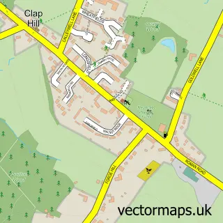
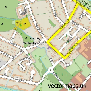
More street maps in Kent
750 metre map area coverage
Boundary, postcode and point of interest information for the 750m x 750m rectangle centred on this sample map.
Boundaries containing map centre
Constituency: Ashford Co Const
County: Kent County
District: Ashford District (B)
Icb: NHS Kent and Medway ICB
Parish: Mersham CP
Police Force: kent
Postcode District: TN25
Postcode Sector: TN25 6
Ward: Mersham, Sevington South with Finberry Ward
Nearby boundaries intersecting sample
Postcode Sector: TN25 7
Postcode coverage
POI category counts
Pub: 2
Shipping Center: 2
Anglican Church: 1
Assisted Living Facility: 1
Beauty Salon: 1
Bed And Breakfast: 1
Carpenter: 1
Church Cathedral: 1
Convenience Store: 1
Elementary School: 1
Sample points of interest
- St John the Baptist, Mersham
- Anderida
- Springwell Therapies, Mersham, Ashford.
- Stone Green Farm B&B
- Agrell Architectural Carving
- Mersham Church
- Mersham Stores
- Mersham Primary School
- Anemone Blue Florist
- Tozer Interiors
- H M Machinery UK
- V C Carpenter
Create a larger editable map of Mersham
This sample shows only a 750 metre area. To create a larger map of Mersham, use our map builder to choose your own coverage area, add titles and download editable SVG, PDF and PNG files.
Create a custom map of Mersham