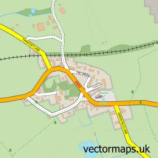
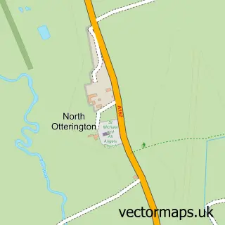
This Morton-on-Swale street map is a detailed vector street map covering a 750m x 750m area. Select a larger area to create and download your own vector street map of Morton-on-Swale.
The 750-metre map sample for Morton-on-Swale covers 208 mapped buildings and approximately 7.6 km of road detail, of which 10 named roads are named. The immediate area includes 2 schools and 1 pub. The wider area around Morton-on-Swale features 1 food and drink venue. To create a larger or custom map of Morton-on-Swale, the map builder lets you define your own coverage area and download editable SVG, PDF and PNG files.
Create a larger editable map of Morton-on-Swale
Choose any area you need and generate a high-quality vector map instantly. Perfect for print, planning, design, business and personal use.

This Morton-on-Swale street map in North Yorkshire is available as downloadable SVG, PDF and PNG map files, or as a printed map for planning, business, display, education, local information and design work. You can also create a larger custom map area using the map selector.
What this Morton-on-Swale map sample shows
Morton-on-Swale lies within Morton-On-Swale Cp parish, part of Morton-On-Swale ward in the North Yorkshire local authority area. The postcode geography for this area includes the DL postcode area, the DL7 postcode district and the DL7 9 postcode sector. Residents fall under the Nhs Humber And North Yorkshire Integrated Care Board for NHS services.
Local features near Morton-on-Swale
Within 2 milesAmenities and services in and around Morton-on-Swale.
Administrative and postcode information for Morton-on-Swale
The local authority covering Morton-on-Swale is North Yorkshire, within the county of North Yorkshire. The settlement lies within Morton-On-Swale ward and Morton-On-Swale Cp civil parish. The DL7 postcode district and DL7 9 postcode sector serve the immediate area. NHS provision in the area is delivered through South Tees Hospitals Nhs Foundation Trust.
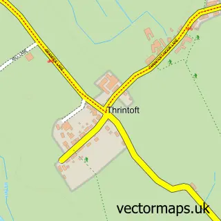
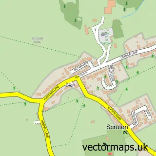
Nearby street map samples around Morton-on-Swale


More street maps in North Yorkshire
750 metre map area coverage
Boundary, postcode and point of interest information for the 750m x 750m rectangle centred on this sample map.
Boundaries containing map centre
Constituency: Richmond and Northallerton Co Const
District: North Yorkshire
Icb: NHS Humber and North Yorkshire ICB
Parish: Morton-on-Swale CP
Police Force: north yorkshire
Postcode District: DL7
Postcode Sector: DL7 9
Nearby boundaries intersecting sample
Parish: Ainderby Steeple CP
Postcode Sector: DL7 0
Postcode coverage
POI category counts
Convenience Store: 1
Driving School: 1
Elementary School: 1
Fish And Chips Restaurant: 1
It Service And Computer Repair: 1
Package Locker: 1
Post Office: 1
Preschool: 1
Pub: 1
Specialty School: 1
Sample points of interest
- The Village Store & Ice Cream
- Nigel Brown Driving Tuition
- Ainderby Steeple Church of England Primary School
- Terry's Fish n Chips
- Coorecom Ltd.
- InPost
- Morton on Swale Post Office
- Scruton Pre School Inc Headstart
- The Royal George
- The Dales School
Create a larger editable map of Morton-on-Swale
This sample shows only a 750 metre area. To create a larger map of Morton-on-Swale, use our map builder to choose your own coverage area, add titles and download editable SVG, PDF and PNG files.
Create a custom map of Morton-on-Swale