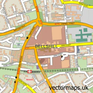
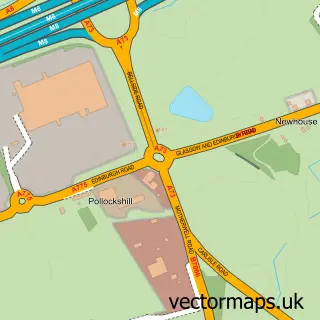
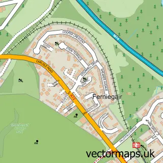
This Mossend street map is a detailed vector street map covering a 750m x 750m area. Select a larger area to create and download your own vector street map of Mossend.
The 750-metre map sample for Mossend covers 278 mapped buildings and approximately 11.7 km of road detail, of which 23 named roads are named. The immediate area includes 6 GP surgeries within 2 miles and 10 MOT stations within 2 miles. The wider area around Mossend features 2 tourism points of interest and 1 food and drink venue. To create a larger or custom map of Mossend, the map builder lets you define your own coverage area and download editable SVG, PDF and PNG files.
Create a larger editable map of Mossend
Choose any area you need and generate a high-quality vector map instantly. Perfect for print, planning, design, business and personal use.

This Mossend street map in Lanarkshire is available as downloadable SVG, PDF and PNG map files, or as a printed map for planning, business, display, education, local information and design work. You can also create a larger custom map area using the map selector.
What this Mossend map sample shows
Mossend lies within North Lanarkshire parish, part of Mossend And Holytown ward in the North Lanarkshire local authority area. The postcode geography for this area includes the ML postcode area, the ML4 postcode district and the ML4 1 postcode sector. Residents fall under the Lanarkshire for NHS services.
Local features near Mossend
Within 2 milesAmenities and services in and around Mossend.
Administrative and postcode information for Mossend
Mossend lies within North Lanarkshire parish, part of Mossend And Holytown ward in the North Lanarkshire local authority area. The postcode geography for this area includes the ML postcode area, the ML4 postcode district and the ML4 1 postcode sector. Residents fall under the Lanarkshire for NHS services.
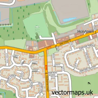
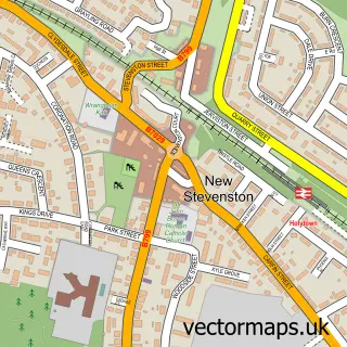
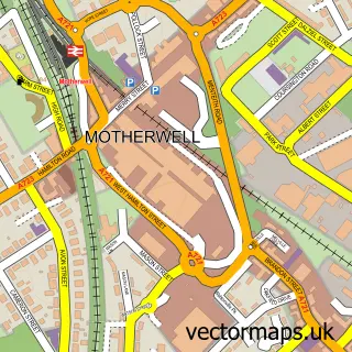
Nearby street map samples around Mossend

More street maps in Lanarkshire
750 metre map area coverage
Boundary, postcode and point of interest information for the 750m x 750m rectangle centred on this sample map.
Boundaries containing map centre
Constituency: Coatbridge and Bellshill Burgh Const
District: North Lanarkshire
Icb: Lanarkshire
Postcode District: ML4
Postcode Sector: ML4 1
Ward: Mossend and Holytown Ward
Nearby boundaries intersecting sample
Constituency: Airdrie and Shotts Co Const
Postcode Sector: ML4 2
Ward: Bellshill Ward
Postcode coverage
POI category counts
Beauty And Spa: 4
Beauty Salon: 4
Convenience Store: 4
Elementary School: 3
Building Supply Store: 2
Chinese Restaurant: 2
Indian Restaurant: 2
Park: 2
Pet Groomer: 2
Professional Services: 2
Sample points of interest
- FSG Promotions
- Ho Wong’s Chinese Takeaway & Silk Road Restaurant
- PayPoint
- 666 cycles & customs
- Kurdish Style Barber
- Melhor Creations
- Mr Skulpt Aesthetics
- Nurse Jade
- TheBaddieroom.x
- Amna's Hair, Beauty & Nails
- B L E N D
- Linda Greig Hairdressing
Create a larger editable map of Mossend
This sample shows only a 750 metre area. To create a larger map of Mossend, use our map builder to choose your own coverage area, add titles and download editable SVG, PDF and PNG files.
Create a custom map of Mossend