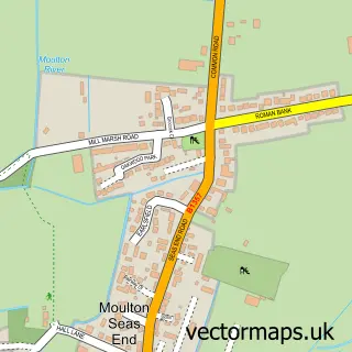
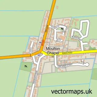
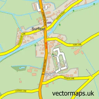
This Moulton street map is a detailed vector street map covering a 750m x 750m area. Select a larger area to create and download your own vector street map of Moulton.
The 750-metre map sample for Moulton covers 346 mapped buildings and approximately 10.7 km of road detail, of which 19 named roads are named. The immediate area includes 1 school, 1 GP surgery, 1 pub and 3 MOT stations within 2 miles. The wider area around Moulton features 3 food and drink venues and 1 campsite within 2 miles. To create a larger or custom map of Moulton, the map builder lets you define your own coverage area and download editable SVG, PDF and PNG files.
Create a larger editable map of Moulton
Choose any area you need and generate a high-quality vector map instantly. Perfect for print, planning, design, business and personal use.

This Moulton street map in Lincolnshire is available as downloadable SVG, PDF and PNG map files, or as a printed map for planning, business, display, education, local information and design work. You can also create a larger custom map area using the map selector.
What this Moulton map sample shows
Moulton lies within The Moultons Cp parish, part of Moulton, Weston And Cowbit ward in the South Holland District local authority area. The postcode geography for this area includes the PE postcode area, the PE12 postcode district and the PE12 6 postcode sector. Residents fall under the Nhs Lincolnshire Integrated Care Board for NHS services.
Local features near Moulton
Within 2 milesAmenities and services in and around Moulton.
Administrative and postcode information for Moulton
The local authority covering Moulton is South Holland District, within the county of Lincolnshire. The settlement lies within Moulton, Weston And Cowbit ward and The Moultons Cp civil parish. The PE12 postcode district and PE12 6 postcode sector serve the immediate area. NHS provision in the area is delivered through United Lincolnshire Hospitals Nhs Trust.
Nearby street map samples around Moulton

More street maps in Lincolnshire
750 metre map area coverage
Boundary, postcode and point of interest information for the 750m x 750m rectangle centred on this sample map.
Boundaries containing map centre
Constituency: South Holland and The Deepings Co Const
County: Lincolnshire County
District: South Holland District
Icb: NHS Lincolnshire ICB
Parish: The Moultons CP
Police Force: lincolnshire
Postcode District: PE12
Postcode Sector: PE12 6
Ward: Moulton, Weston and Cowbit Ward
Nearby boundaries intersecting sample
No additional intersecting boundaries found.
Postcode coverage
POI category counts
Church Cathedral: 2
Community Services Non Profits: 2
Sports Club And League: 2
Anglican Church: 1
Bakery: 1
Beauty And Spa: 1
Beauty Salon: 1
Broadcasting Media Production: 1
Building Supply Store: 1
Burger Restaurant: 1
Sample points of interest
- All Saints, Moulton
- Vintage Cake Craft
- The Little Village Salon
- Altered Images Beauty & Hair
- Moulton Community Association Limited
- Spalding Electrical
- Eastern Delight
- Moulton Butchers
- Gillings Outside Catering
- All Saints Church
- Moulton Church
- Moulton Windmill
Create a larger editable map of Moulton
This sample shows only a 750 metre area. To create a larger map of Moulton, use our map builder to choose your own coverage area, add titles and download editable SVG, PDF and PNG files.
Create a custom map of Moulton