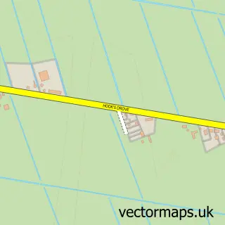
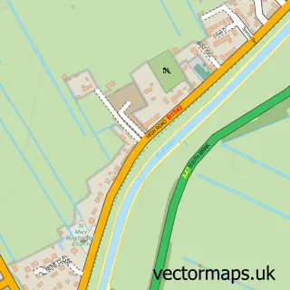
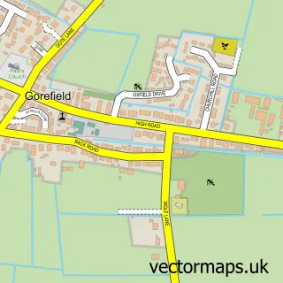
This Murrow street map is a detailed vector street map covering a 750m x 750m area. Select a larger area to create and download your own vector street map of Murrow.
The 750-metre map sample for Murrow covers 250 mapped buildings and approximately 11.7 km of road detail, of which 8 named roads are named. The immediate area includes 1 GP surgery within 2 miles and 2 pubs. The wider area around Murrow features 1 tourism point of interest and 2 food and drink venues. To create a larger or custom map of Murrow, the map builder lets you define your own coverage area and download editable SVG, PDF and PNG files.
Create a larger editable map of Murrow
Choose any area you need and generate a high-quality vector map instantly. Perfect for print, planning, design, business and personal use.

This Murrow street map in Cambridgeshire is available as downloadable SVG, PDF and PNG map files, or as a printed map for planning, business, display, education, local information and design work. You can also create a larger custom map area using the map selector.
What this Murrow map sample shows
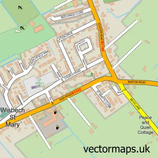
Murrow lies within Wisbech St. Mary Cp parish, part of Parson Drove & Wisbech St Mary ward in the Fenland District local authority area. The postcode geography for this area includes the PE postcode area, the PE13 postcode district and the PE13 4 postcode sector. Residents fall under the Nhs Cambridgeshire And Peterborough Integrated Care Board for NHS services.
Local features near Murrow
Within 2 milesAmenities and services in and around Murrow.
Administrative and postcode information for Murrow
The local authority covering Murrow is Fenland District, within the county of Cambridgeshire. The settlement lies within Parson Drove & Wisbech St Mary ward and Wisbech St. Mary Cp civil parish. The PE13 postcode district and PE13 4 postcode sector serve the immediate area. NHS provision in the area is delivered through The Queen Elizabeth Hospital, King's Lynn, Nhs Foundation Trust.
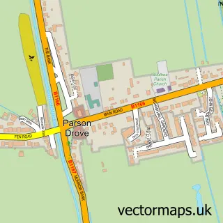
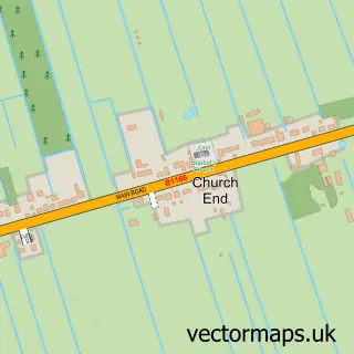
Nearby street map samples around Murrow

More street maps in Cambridgeshire
750 metre map area coverage
Boundary, postcode and point of interest information for the 750m x 750m rectangle centred on this sample map.
Boundaries containing map centre
Constituency: North East Cambridgeshire Co Const
County: Cambridgeshire County
District: Fenland District
Icb: NHS Central East ICB
Parish: Wisbech St. Mary CP
Police Force: cambridgeshire
Postcode District: PE13
Postcode Sector: PE13 4
Ward: Parson Drove & Wisbech St. Mary Ward
Nearby boundaries intersecting sample
Parish: Parson Drove CP
Postcode coverage
POI category counts
Flowers And Gifts Shop: 3
Pub: 2
Building Supply Store: 1
Community Center: 1
Fish Farms And Hatcheries: 1
Funeral Services And Cemeteries: 1
Garbage Collection Service: 1
Landscape Architect: 1
Landscaping: 1
Park: 1
Sample points of interest
- 1st Call Gardening & Ground Care
- Murrow Village Hall
- Alvenor Aquatics
- A Fairy Godmothers Touch
- Any Occasion Flowers For You
- Ashes to Keepsakes
- Peter Barnes Funerals
- K.M.A Utilities Limited
- Clive Wardill Landscapes
- Oliver Wardill Services
- Murrow park
- The Bell Murrow
Create a larger editable map of Murrow
This sample shows only a 750 metre area. To create a larger map of Murrow, use our map builder to choose your own coverage area, add titles and download editable SVG, PDF and PNG files.
Create a custom map of Murrow