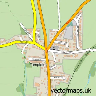
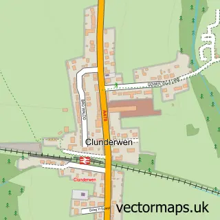
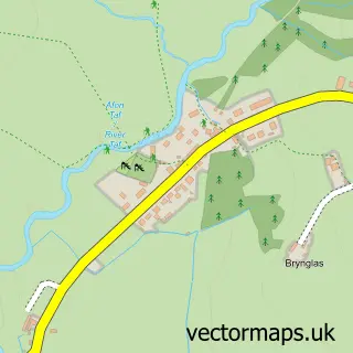
This Narberth street map is a detailed vector street map covering a 750m x 750m area. Select a larger area to create and download your own vector street map of Narberth.
The 750-metre map sample for Narberth covers 258 mapped buildings and approximately 12.5 km of road detail, of which 38 named roads are named. The immediate area includes 2 schools, 7 pubs and 1 MOT station, with 4 within 2 miles. The wider area around Narberth features 1 tourism point of interest, 18 food and drink venues and 2 hotels. To create a larger or custom map of Narberth, the map builder lets you define your own coverage area and download editable SVG, PDF and PNG files.
Create a larger editable map of Narberth
Choose any area you need and generate a high-quality vector map instantly. Perfect for print, planning, design, business and personal use.

This Narberth street map in Dyfed is available as downloadable SVG, PDF and PNG map files, or as a printed map for planning, business, display, education, local information and design work. You can also create a larger custom map area using the map selector.
What this Narberth map sample shows
Narberth lies within Narberth Community parish, part of Narberth ward in the Sir Benfro - Pembrokeshire local authority area. The postcode geography for this area includes the SA postcode area, the SA67 postcode district and the SA67 7 postcode sector. Residents fall under the Hywel Dda University Health Board for NHS services.
Local features near Narberth
Within 2 milesAmenities and services in and around Narberth.
Administrative and postcode information for Narberth
Narberth lies within Narberth Community parish, part of Narberth ward in the Sir Benfro - Pembrokeshire local authority area. The postcode geography for this area includes the SA postcode area, the SA67 postcode district and the SA67 7 postcode sector. Residents fall under the Hywel Dda University Health Board for NHS services.
Nearby street map samples around Narberth

More street maps in Dyfed
750 metre map area coverage
Boundary, postcode and point of interest information for the 750m x 750m rectangle centred on this sample map.
Boundaries containing map centre
Constituency: Mid and South Pembrokeshire Co Const
District: Sir Benfro - Pembrokeshire
Icb: Hywel Dda
Parish: Narberth Community
Police Force: dyfed-powys
Postcode District: SA67
Postcode Sector: SA67 7
Nearby boundaries intersecting sample
Postcode Sector: SA67 8
Postcode coverage
POI category counts
Clothing Store: 9
Art Gallery: 7
Pub: 7
Convenience Store: 5
Professional Services: 5
Antique Store: 4
Bakery: 4
Butcher Shop: 4
Cafe: 4
Coffee Shop: 4
Sample points of interest
- Bazaar Vintage & Antique Warehouse
- Malt House Antiques
- Malthouse Antiques
- Narberth Antiques & Interiors
- John Francis Ltd.
- Steve Hole Architects LLP
- Creative Cafe
- Narberth Pottery
- Oriel Q
- Oriel Queens Hall Gallery
- The Golden Sheaf Gallery
- The Makers at The Narberth Gallery
Create a larger editable map of Narberth
This sample shows only a 750 metre area. To create a larger map of Narberth, use our map builder to choose your own coverage area, add titles and download editable SVG, PDF and PNG files.
Create a custom map of Narberth