Vector Maps logo
Home Why it works Popular maps Districts Samples Customizer Create Your Map
VectorMaps.uk
Home Popular maps Districts Samples Customizer Create Your Map Privacy Disclaimer
Home / UK Maps / The Stewartry of Kirkcudbright / New Galloway Map

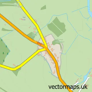
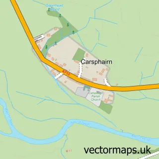
This New Galloway street map is a detailed vector street map covering a 750m x 750m area. Select a larger area to create and download your own vector street map of New Galloway.

New Galloway is a village in The Stewartry Of Kirkcudbright, in the South Scotland of Scotland. Historically, the area formed part of Kirkcudbrightshire. The settlement falls within the Dumfries And Galloway parliamentary constituency. It is served by the

The 750-metre map sample for New Galloway covers 149 mapped buildings and approximately 9.9 km of road detail, of which 11 named roads are named. The immediate area includes 1 GP surgery. The wider area around New Galloway features 1 tourism point of interest, 4 food and drink venues and 2 hotels. To create a larger or custom map of New Galloway, the map builder lets you define your own coverage area and download editable SVG, PDF and PNG files.

149Buildings
9.85 kmRoads
11Named roads
0Residents within 2 miles
Create your own

Create a larger editable map of New Galloway

Choose any area you need and generate a high-quality vector map instantly. Perfect for print, planning, design, business and personal use.

Choose any location
Editable SVG files
Any size up to A0
PDF, PNG & more
Instant download
High quality guaranteed
Create My Custom Map
Secure, private & no credit card required
New Galloway Vector Street Map
750m Sample
New Galloway vector street map sample showing roads, buildings and local features in a 750 metre preview area
Buy New Galloway Map Print from £12.95 Buy New Galloway Digital Map from £6

This New Galloway street map in The Stewartry of Kirkcudbright is available as downloadable SVG, PDF and PNG map files, or as a printed map for planning, business, display, education, local information and design work. You can also create a larger custom map area using the map selector.

What this New Galloway map sample shows

New Galloway lies within Dumfries And Galloway parish, part of Dee And Glenkens ward in the Dumfries And Galloway local authority area. The postcode geography for this area includes the DG postcode area, the DG7 postcode district and the DG7 3 postcode sector. Residents fall under the Dumfries And Galloway for NHS services.

Local features near New Galloway

Within 2 miles

Amenities and services in and around New Galloway.

1 GP surgeries 1 within 2 miles
1 Tourism & leisure
4 Food & drink
2 Hotels
1 Healthcare POIs

Counts are approximate and based on publicly available data.

Administrative and postcode information for New Galloway

New Galloway lies within Dumfries And Galloway parish, part of Dee And Glenkens ward in the Dumfries And Galloway local authority area. The postcode geography for this area includes the DG postcode area, the DG7 postcode district and the DG7 3 postcode sector. Residents fall under the Dumfries And Galloway for NHS services.

Parish DUMFRIES AND GALLOWAY
Ward Dee and Glenkens
District / local authority Dumfries and Galloway
County The Stewartry of Kirkcudbright
Historic county Kirkcudbrightshire
Postcode district DG7
Postcode sector DG7 3
Parliamentary constituency Dumfries and Galloway
Region South Scotland
Country Scotland

Nearby street map samples around New Galloway

Street map sample of Castle Douglas, The Stewartry of Kirkcudbright Castle Douglas Town - The Stewartry of Kirkcudbright - 12.5 miles Street map sample of Carlisle, Cumbria Carlisle City - Cumbria - 49.3 miles Street map sample of Balmaclellan, The Stewartry of Kirkcudbright Balmaclellan Village - The Stewartry of Kirkcudbright - 1.5 miles Street map sample of St John's Town of Dalry, The Stewartry of Kirkcudbright St John's Town of Dalry Village - The Stewartry of Kirkcudbright - 2.4 miles Street map sample of Parton, The Stewartry of Kirkcudbright Parton Village - The Stewartry of Kirkcudbright - 6.0 miles Street map sample of Corsock, The Stewartry of Kirkcudbright Corsock Village - The Stewartry of Kirkcudbright - 7.7 miles Street map sample of Laurieston, The Stewartry of Kirkcudbright Laurieston Village - The Stewartry of Kirkcudbright - 8.5 miles Street map sample of Crossmichael, The Stewartry of Kirkcudbright Crossmichael Village - The Stewartry of Kirkcudbright - 9.0 miles Street map sample of Kirkpatrick Durham, The Stewartry of Kirkcudbright Kirkpatrick Durham Village - The Stewartry of Kirkcudbright - 10.6 miles Street map sample of Carsphairn, The Stewartry of Kirkcudbright Carsphairn Village - The Stewartry of Kirkcudbright - 10.7 miles

More street maps in The Stewartry of Kirkcudbright

Street map sample of Balmaclellan, The Stewartry of Kirkcudbright Balmaclellan Village - 1.5 miles Street map sample of St John's Town of Dalry, The Stewartry of Kirkcudbright St John's Town of Dalry Village - 2.4 miles Street map sample of Parton, The Stewartry of Kirkcudbright Parton Village - 6.0 miles Street map sample of Corsock, The Stewartry of Kirkcudbright Corsock Village - 7.7 miles Street map sample of Laurieston, The Stewartry of Kirkcudbright Laurieston Village - 8.5 miles

750 metre map area coverage

Boundary, postcode and point of interest information for the 750m x 750m rectangle centred on this sample map.

Boundaries containing map centre

Constituency: Dumfries and Galloway Co Const

District: Dumfries and Galloway

Icb: Dumfries and Galloway

Postcode District: DG7

Postcode Sector: DG7 3

Ward: Dee and Glenkens Ward

Nearby boundaries intersecting sample

No additional intersecting boundaries found.

Postcode coverage

DG7 DG7 3

POI category counts

Hotel: 2

Restaurant: 2

Bed And Breakfast: 1

Business Management Services: 1

Cafe: 1

Coffee Shop: 1

Community Center: 1

Convenience Store: 1

Doctor: 1

Elementary School: 1

Sample points of interest

  • Cruachan House Bed And Breakfast
  • Small Business Solutions Business Management Services
  • Kitty's Tearooms Cafe
  • The Smithy Coffee Shop
  • CatStrand Community Center
  • New Galloway Community Shop Convenience Store
  • Glenkens Medical Practice Doctor
  • Kells Primary School Elementary School
  • Loch Ken Activity Centre Gym
  • Kenmure Arms Hotel Hotel
  • The Cross Keys Hotel Hotel
  • New Galloway Park Park

Create a larger editable map of New Galloway

This sample shows only a 750 metre area. To create a larger map of New Galloway, use our map builder to choose your own coverage area, add titles and download editable SVG, PDF and PNG files.

Create a custom map of New Galloway

Phone 01751 473136 | Copyright Vectormaps.uk 2026

Samples Customizer Privacy Disclaimer
New Galloway Vector Street Map
New Galloway enlarged street map sample showing a 750 metre preview area