Vector Maps logo
Home Why it works Popular maps Districts Samples Customizer Create Your Map
VectorMaps.uk
Home Popular maps Districts Samples Customizer Create Your Map Privacy Disclaimer
Home / UK Maps / Lincolnshire / New York Map

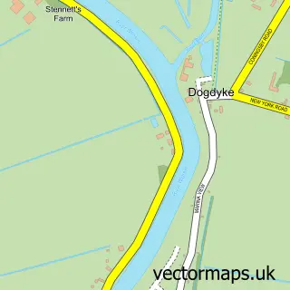
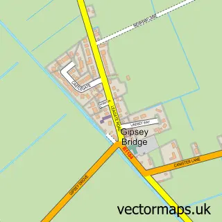
This New York street map is a detailed vector street map covering a 750m x 750m area. Select a larger area to create and download your own vector street map of New York.

New York is a village in Lincolnshire, in the East Midlands of England. The settlement falls within the Louth And Horncastle parliamentary constituency. It is served by the LN4 postcode district, with LN4 4 as the local postcode sector.

The 750-metre map sample for New York covers 92 mapped buildings and approximately 7.4 km of road detail, of which 4 named roads are named. The immediate area includes 1 MOT station within 2 miles. To create a larger or custom map of New York, the map builder lets you define your own coverage area and download editable SVG, PDF and PNG files.

92Buildings
7.41 kmRoads
4Named roads
656Residents within 2 miles
Create your own

Create a larger editable map of New York

Choose any area you need and generate a high-quality vector map instantly. Perfect for print, planning, design, business and personal use.

Choose any location
Editable SVG files
Any size up to A0
PDF, PNG & more
Instant download
High quality guaranteed
Create My Custom Map
Secure, private & no credit card required
New York Vector Street Map
750m Sample
New York vector street map sample showing roads, buildings and local features in a 750 metre preview area
Buy New York Map Print from £12.95 Buy New York Digital Map from £6

This New York street map in Lincolnshire is available as downloadable SVG, PDF and PNG map files, or as a printed map for planning, business, display, education, local information and design work. You can also create a larger custom map area using the map selector.

What this New York map sample shows

New York lies within Wildmore Cp parish, part of Coningsby & Mareham ward in the East Lindsey District local authority area. The postcode geography for this area includes the LN postcode area, the LN4 postcode district and the LN4 4 postcode sector. Residents fall under the Nhs Lincolnshire Integrated Care Board for NHS services.

Local features near New York

Within 2 miles

Amenities and services in and around New York.

1 MOT stations within 2 miles

Counts are approximate and based on publicly available data.

Administrative and postcode information for New York

New York lies within Wildmore Cp parish, part of Coningsby & Mareham ward in the East Lindsey District local authority area. The postcode geography for this area includes the LN postcode area, the LN4 postcode district and the LN4 4 postcode sector. Residents fall under the Nhs Lincolnshire Integrated Care Board for NHS services.

Parish Wildmore CP
Ward Coningsby & Mareham
District / local authority East Lindsey District
County Lincolnshire
Historic county Lincolnshire
Postcode district LN4
Postcode sector LN4 4
Parliamentary constituency Louth and Horncastle
Region East Midlands
Country England

Nearby street map samples around New York

Street map sample of Coningsby, Lincolnshire Coningsby Town - Lincolnshire - 2.4 miles Street map sample of Lincoln, Lincolnshire Lincoln City - Lincolnshire - 19.6 miles Street map sample of Dogdyke, Lincolnshire Dogdyke Village - Lincolnshire - 2.4 miles Street map sample of Chapel Hill, Lincolnshire Chapel Hill Village - Lincolnshire - 2.5 miles Street map sample of Tattershall, Lincolnshire Tattershall Village - Lincolnshire - 2.8 miles Street map sample of Tattershall Thorpe, Lincolnshire Tattershall Thorpe Village - Lincolnshire - 3.5 miles Street map sample of Gipsey Bridge, Lincolnshire Gipsey Bridge Village - Lincolnshire - 3.8 miles Street map sample of Langrick, Lincolnshire Langrick Village - Lincolnshire - 4.1 miles Street map sample of New Bolingbroke, Lincolnshire New Bolingbroke Village - Lincolnshire - 4.2 miles Street map sample of Mareham le Fen, Lincolnshire Mareham le Fen Village - Lincolnshire - 4.2 miles

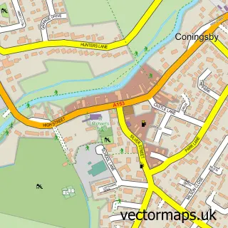
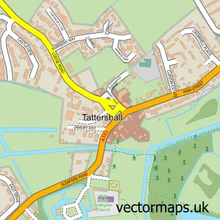
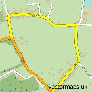
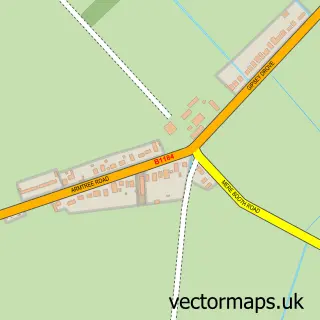
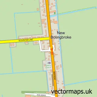
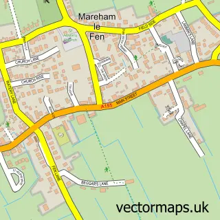
More street maps in Lincolnshire

Street map sample of Coningsby, Lincolnshire Coningsby Town - 2.4 miles Street map sample of Dogdyke, Lincolnshire Dogdyke Village - 2.4 miles Street map sample of Chapel Hill, Lincolnshire Chapel Hill Village - 2.5 miles Street map sample of Tattershall, Lincolnshire Tattershall Village - 2.8 miles Street map sample of Tattershall Thorpe, Lincolnshire Tattershall Thorpe Village - 3.5 miles

750 metre map area coverage

Boundary, postcode and point of interest information for the 750m x 750m rectangle centred on this sample map.

Boundaries containing map centre

Constituency: Louth and Horncastle Co Const

County: Lincolnshire County

District: East Lindsey District

Icb: NHS Lincolnshire ICB

Parish: Wildmore CP

Police Force: lincolnshire

Postcode District: LN4

Postcode Sector: LN4 4

Ward: Coningsby & Mareham Ward

Nearby boundaries intersecting sample

Parish: Coningsby CP

Postcode coverage

LN4 LN4 4

POI category counts

Antique Store: 1

Automotive Parts And Accessories: 1

Carpet Store: 1

Financial Service: 1

Pet Store: 1

Public Service And Government: 1

Shopping: 1

Sample points of interest

  • Antique Furniture Designs Antique Store
  • World Car Parts Automotive Parts And Accessories
  • Linx Flooring Carpet Store
  • Money Back Helper Financial Service
  • Lincolnshire Wild Bird Seeds Pet Store
  • New York Village Hall Public Service And Government
  • Paladin Radiators Shopping

Create a larger editable map of New York

This sample shows only a 750 metre area. To create a larger map of New York, use our map builder to choose your own coverage area, add titles and download editable SVG, PDF and PNG files.

Create a custom map of New York

Phone 01751 473136 | Copyright Vectormaps.uk 2026

Samples Customizer Privacy Disclaimer
New York Vector Street Map
New York enlarged street map sample showing a 750 metre preview area