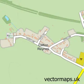
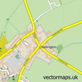
This Newton Blossomville street map is a detailed vector street map covering a 750m x 750m area. Select a larger area to create and download your own vector street map of Newton Blossomville.
The 750-metre map sample for Newton Blossomville covers 65 mapped buildings and approximately 12.2 km of road detail, of which 3 named roads are named. The immediate area includes 1 school, 1 pub and 1 MOT station within 2 miles. The wider area around Newton Blossomville features 1 food and drink venue and 1 hotel. To create a larger or custom map of Newton Blossomville, the map builder lets you define your own coverage area and download editable SVG, PDF and PNG files.
Create a larger editable map of Newton Blossomville
Choose any area you need and generate a high-quality vector map instantly. Perfect for print, planning, design, business and personal use.

This Newton Blossomville street map in Buckinghamshire is available as downloadable SVG, PDF and PNG map files, or as a printed map for planning, business, display, education, local information and design work. You can also create a larger custom map area using the map selector.
What this Newton Blossomville map sample shows
Newton Blossomville lies within Newton Blossomville Cp parish, part of Olney ward in the Milton Keynes (B) local authority area. The postcode geography for this area includes the MK postcode area, the MK43 postcode district and the MK43 8 postcode sector. Residents fall under the Nhs Bedfordshire, Luton And Milton Keynes Integrated Care Board for NHS services.
Local features near Newton Blossomville
Within 2 milesAmenities and services in and around Newton Blossomville.
Administrative and postcode information for Newton Blossomville
Newton Blossomville lies within Newton Blossomville Cp parish, part of Olney ward in the Milton Keynes (B) local authority area. The postcode geography for this area includes the MK postcode area, the MK43 postcode district and the MK43 8 postcode sector. Residents fall under the Nhs Bedfordshire, Luton And Milton Keynes Integrated Care Board for NHS services.
Nearby street map samples around Newton Blossomville

More street maps in Buckinghamshire
750 metre map area coverage
Boundary, postcode and point of interest information for the 750m x 750m rectangle centred on this sample map.
Boundaries containing map centre
Constituency: Milton Keynes North Co Const
District: Milton Keynes (B)
Icb: NHS Central East ICB
Parish: Newton Blossomville CP
Police Force: thames valley
Postcode District: MK43
Postcode Sector: MK43 8
Ward: Olney Ward
Nearby boundaries intersecting sample
Parish: Cold Brayfield CP
Postcode District: MK46
Postcode Sector: MK46 4
Postcode coverage
POI category counts
Advertising Agency: 1
Anglican Church: 1
Chimney Sweep: 1
Corporate Office: 1
Education: 1
Hotel: 1
Pub: 1
Roofing: 1
School: 1
Sample points of interest
- Art in Marketing
- Newton Blossomville St Nicholas
- RJL Chimneys
- Berics Accounting
- Stable and Wild
- The Old Mill Inn
- The Old Mill, Newton Blossomville
- S D Farrell
- Newton Blossomville Church of England School
Create a larger editable map of Newton Blossomville
This sample shows only a 750 metre area. To create a larger map of Newton Blossomville, use our map builder to choose your own coverage area, add titles and download editable SVG, PDF and PNG files.
Create a custom map of Newton Blossomville