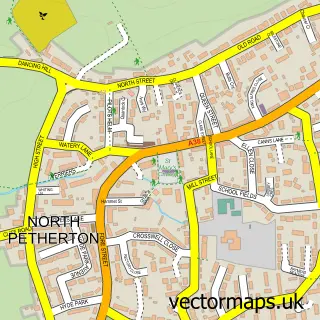
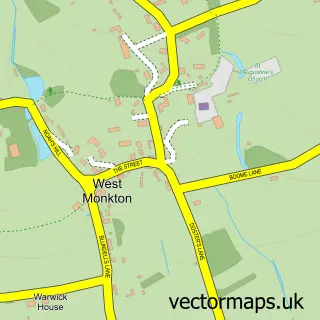
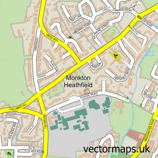
This North Newton street map is a detailed vector street map covering a 750m x 750m area. Select a larger area to create and download your own vector street map of North Newton.
The 750-metre map sample for North Newton covers 207 mapped buildings and approximately 5.5 km of road detail, of which 5 named roads are named. The immediate area includes 1 school, 1 GP surgery within 2 miles, 1 pub and 1 MOT station within 2 miles. The wider area around North Newton features 2 food and drink venues. To create a larger or custom map of North Newton, the map builder lets you define your own coverage area and download editable SVG, PDF and PNG files.
Create a larger editable map of North Newton
Choose any area you need and generate a high-quality vector map instantly. Perfect for print, planning, design, business and personal use.

This North Newton street map in Somerset is available as downloadable SVG, PDF and PNG map files, or as a printed map for planning, business, display, education, local information and design work. You can also create a larger custom map area using the map selector.
What this North Newton map sample shows
North Newton lies within North Petherton Cp parish, part of North Petherton ward in the Somerset local authority area. The postcode geography for this area includes the TA postcode area, the TA7 postcode district and the TA7 0 postcode sector. Residents fall under the Nhs Somerset Integrated Care Board for NHS services.
Local features near North Newton
Within 2 milesAmenities and services in and around North Newton.
Administrative and postcode information for North Newton
North Newton lies within North Petherton Cp parish, part of North Petherton ward in the Somerset local authority area. The postcode geography for this area includes the TA postcode area, the TA7 postcode district and the TA7 0 postcode sector. Residents fall under the Nhs Somerset Integrated Care Board for NHS services.
Nearby street map samples around North Newton

More street maps in Somerset
750 metre map area coverage
Boundary, postcode and point of interest information for the 750m x 750m rectangle centred on this sample map.
Boundaries containing map centre
Constituency: Bridgwater Co Const
District: Somerset
Icb: NHS Somerset ICB
Parish: North Petherton CP
Police Force: avon and somerset
Postcode District: TA7
Postcode Sector: TA7 0
Nearby boundaries intersecting sample
No additional intersecting boundaries found.
Postcode coverage
POI category counts
Church Cathedral: 2
Anglican Church: 1
Beauty Salon: 1
Child Care And Day Care: 1
Community Center: 1
Cricket Ground: 1
Elementary School: 1
Event Planning: 1
Fast Food Restaurant: 1
Financial Service: 1
Sample points of interest
- St Peter
- Rose Healing Within
- Little Steps Pre-School
- Church of St Peter, North Newton
- St Peter's Church
- North Newton Village Hall - New
- North Newton Cricket Club
- North Newton Community Primary School
- Taste of Somerset
- A38 Thurloxton Lay-by All Day Breakfast
- CKA Consultancy
- Dragonfly Barn
Create a larger editable map of North Newton
This sample shows only a 750 metre area. To create a larger map of North Newton, use our map builder to choose your own coverage area, add titles and download editable SVG, PDF and PNG files.
Create a custom map of North Newton