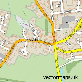
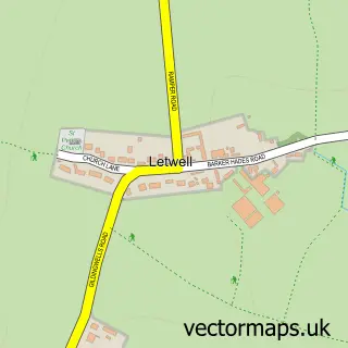
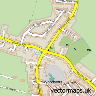
This Oldcotes street map is a detailed vector street map covering a 750m x 750m area. Select a larger area to create and download your own vector street map of Oldcotes.
The 750-metre map sample for Oldcotes covers 153 mapped buildings and approximately 17.4 km of road detail, of which 7 named roads are named. The immediate area includes 1 pub and 2 MOT stations within 2 miles. The wider area around Oldcotes features 1 tourism point of interest and 2 food and drink venues. To create a larger or custom map of Oldcotes, the map builder lets you define your own coverage area and download editable SVG, PDF and PNG files.
Create a larger editable map of Oldcotes
Choose any area you need and generate a high-quality vector map instantly. Perfect for print, planning, design, business and personal use.

This Oldcotes street map in Nottinghamshire is available as downloadable SVG, PDF and PNG map files, or as a printed map for planning, business, display, education, local information and design work. You can also create a larger custom map area using the map selector.
What this Oldcotes map sample shows
Oldcotes lies within Styrrup With Oldcotes Cp parish, part of Blyth ward in the Bassetlaw District local authority area. The postcode geography for this area includes the S postcode area, the S81 postcode district and the S81 8 postcode sector. Residents fall under the Nhs Nottingham And Nottinghamshire Integrated Care Board for NHS services.
Local features near Oldcotes
Within 2 milesAmenities and services in and around Oldcotes.
Administrative and postcode information for Oldcotes
The local authority covering Oldcotes is Bassetlaw District, within the county of Nottinghamshire. The settlement lies within Blyth ward and Styrrup With Oldcotes Cp civil parish. The S81 postcode district and S81 8 postcode sector serve the immediate area. NHS provision in the area is delivered through Doncaster And Bassetlaw Teaching Hospitals Nhs Foundation Trust.
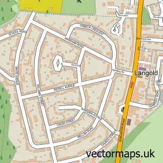
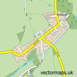
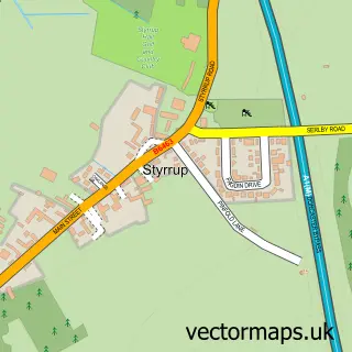
Nearby street map samples around Oldcotes

More street maps in Nottinghamshire
750 metre map area coverage
Boundary, postcode and point of interest information for the 750m x 750m rectangle centred on this sample map.
Boundaries containing map centre
Constituency: Bassetlaw Co Const
County: Nottinghamshire County
District: Bassetlaw District
Icb: NHS Nottingham and Nottinghamshire ICB
Parish: Styrrup with Oldcotes CP
Police Force: nottinghamshire
Postcode District: S81
Postcode Sector: S81 8
Ward: Blyth Ward
Nearby boundaries intersecting sample
Parish: Hodsock CP
Postcode Sector: S81 9
Ward: Langold Ward
Postcode coverage
POI category counts
Church Cathedral: 2
Cafe: 1
Cards And Stationery Store: 1
Community Center: 1
Contractor: 1
Disability Services And Support Organization: 1
Electrician: 1
Flowers And Gifts Shop: 1
Holiday Rental Home: 1
Irish Pub: 1
Sample points of interest
- Oldcotes Cafe
- Cachet UK Ltd.
- St Helens Church
- St Mark's Church
- Oldcotes Village Hall
- M. West Roofing and Building Services
- Rivers Voyage Care
- Steve Wade Electrical Contractors
- Cachet Cards
- Enfield House & Cottages
- King William Iv Brewers Fayre
- Rivers
Create a larger editable map of Oldcotes
This sample shows only a 750 metre area. To create a larger map of Oldcotes, use our map builder to choose your own coverage area, add titles and download editable SVG, PDF and PNG files.
Create a custom map of Oldcotes