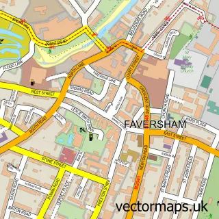
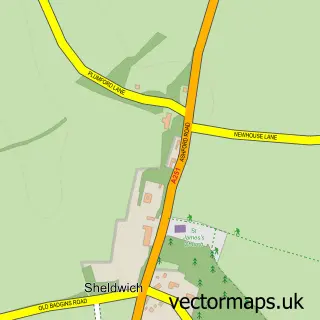
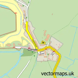
This Ospringe street map is a detailed vector street map covering a 750m x 750m area. Select a larger area to create and download your own vector street map of Ospringe.
The 750-metre map sample for Ospringe covers 266 mapped buildings and approximately 19.3 km of road detail, of which 23 named roads are named. The immediate area includes 1 school, 2 GP surgeries within 2 miles, 1 pub and 1 MOT station, with 4 within 2 miles. The wider area around Ospringe features 5 tourism points of interest and 1 food and drink venue. To create a larger or custom map of Ospringe, the map builder lets you define your own coverage area and download editable SVG, PDF and PNG files.
Create a larger editable map of Ospringe
Choose any area you need and generate a high-quality vector map instantly. Perfect for print, planning, design, business and personal use.

This Ospringe street map in Kent is available as downloadable SVG, PDF and PNG map files, or as a printed map for planning, business, display, education, local information and design work. You can also create a larger custom map area using the map selector.
What this Ospringe map sample shows
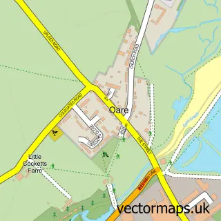
Ospringe lies within Ospringe Cp parish, part of East Downs ward in the Swale District (B) local authority area. The postcode geography for this area includes the ME postcode area, the ME13 postcode district and the ME13 8 postcode sector. Residents fall under the Nhs Kent And Medway Integrated Care Board for NHS services.
Local features near Ospringe
Within 2 milesAmenities and services in and around Ospringe.
Administrative and postcode information for Ospringe
The local authority covering Ospringe is Swale District (B), within the county of Kent. The settlement lies within East Downs ward and Ospringe Cp civil parish. The ME13 postcode district and ME13 8 postcode sector serve the immediate area. NHS provision in the area is delivered through East Kent Hospitals University Nhs Foundation Trust.
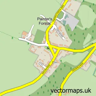
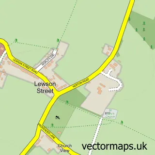
Nearby street map samples around Ospringe

More street maps in Kent
750 metre map area coverage
Boundary, postcode and point of interest information for the 750m x 750m rectangle centred on this sample map.
Boundaries containing map centre
Constituency: Faversham and Mid Kent Co Const
County: Kent County
District: Swale District (B)
Icb: NHS Kent and Medway ICB
Parish: Faversham CP
Police Force: kent
Postcode District: ME13
Postcode Sector: ME13 8
Ward: Watling Ward
Nearby boundaries intersecting sample
Parish: Ospringe CP
Postcode Sector: ME13 7
Ward: East Downs Ward, St. Ann's Ward
Postcode coverage
POI category counts
Auto Body Shop: 2
Automotive Repair: 2
Convenience Store: 2
History Museum: 2
Post Office: 2
Used Car Dealer: 2
Amateur Sports Team: 1
Art Gallery: 1
Art Museum: 1
Atms: 1
Sample points of interest
- Faversham Strike Force Football Club
- Wyards Print & Arts Work
- Maison Dieu
- PayPoint
- Maison Dieu
- Car Smart
- JF Autobody
- G & E Newbery & Son
- MOT's Only Limited
- Tease
- Holly Cottage Bed and Breakfast Faversham
- Oiltec Services
Create a larger editable map of Ospringe
This sample shows only a 750 metre area. To create a larger map of Ospringe, use our map builder to choose your own coverage area, add titles and download editable SVG, PDF and PNG files.
Create a custom map of Ospringe