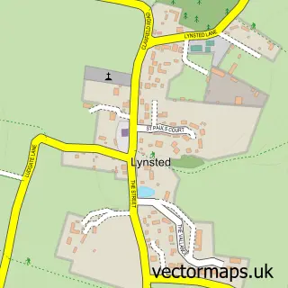
This Painter's Forstal street map is a detailed vector street map covering a 750m x 750m area. Select a larger area to create and download your own vector street map of Painter's Forstal.
The 750-metre map sample for Painter's Forstal covers 104 mapped buildings and approximately 7.5 km of road detail, of which 6 named roads are named. The immediate area includes 1 school, 1 GP surgery within 2 miles, 2 pubs and 2 MOT stations within 2 miles. The wider area around Painter's Forstal features 1 tourism point of interest and 2 food and drink venues. To create a larger or custom map of Painter's Forstal, the map builder lets you define your own coverage area and download editable SVG, PDF and PNG files.
Create a larger editable map of Painter's Forstal
Choose any area you need and generate a high-quality vector map instantly. Perfect for print, planning, design, business and personal use.

This Painter's Forstal street map in Kent is available as downloadable SVG, PDF and PNG map files, or as a printed map for planning, business, display, education, local information and design work. You can also create a larger custom map area using the map selector.
What this Painter's Forstal map sample shows
Painter's Forstal lies within Ospringe Cp parish, part of East Downs ward in the Swale District (B) local authority area. The postcode geography for this area includes the ME postcode area, the ME13 postcode district and the ME13 0 postcode sector. Residents fall under the Nhs Kent And Medway Integrated Care Board for NHS services.
Local features near Painter's Forstal
Within 2 milesAmenities and services in and around Painter's Forstal.
Administrative and postcode information for Painter's Forstal
The local authority covering Painter's Forstal is Swale District (B), within the county of Kent. The settlement lies within East Downs ward and Ospringe Cp civil parish. The ME13 postcode district and ME13 0 postcode sector serve the immediate area. NHS provision in the area is delivered through East Kent Hospitals University Nhs Foundation Trust.
Nearby street map samples around Painter's Forstal

More street maps in Kent
750 metre map area coverage
Boundary, postcode and point of interest information for the 750m x 750m rectangle centred on this sample map.
Boundaries containing map centre
Constituency: Faversham and Mid Kent Co Const
County: Kent County
District: Swale District (B)
Icb: NHS Kent and Medway ICB
Parish: Ospringe CP
Police Force: kent
Postcode District: ME13
Postcode Sector: ME13 0
Ward: East Downs Ward
Nearby boundaries intersecting sample
No additional intersecting boundaries found.
Postcode coverage
POI category counts
Elementary School: 2
Farm: 2
Pub: 2
Anglican Church: 1
Bridal Shop: 1
Campground: 1
Preschool: 1
Roofing: 1
Sample points of interest
- Anglican Catholic Church of St Augustine, Painters Forstal, Kent
- Kent Essential
- Painters Farm
- Lorenden Prep School
- Lorenden Preparatory School
- Shavers Meadow Cut Flowers
- Woodhill Campsite
- Little Poppins Pre-School
- Alma
- The Alma
- L Cole Roofing
Create a larger editable map of Painter's Forstal
This sample shows only a 750 metre area. To create a larger map of Painter's Forstal, use our map builder to choose your own coverage area, add titles and download editable SVG, PDF and PNG files.
Create a custom map of Painter's Forstal