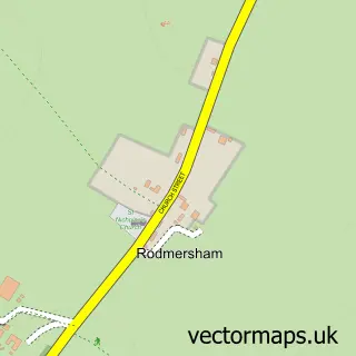
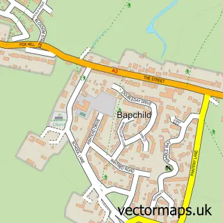
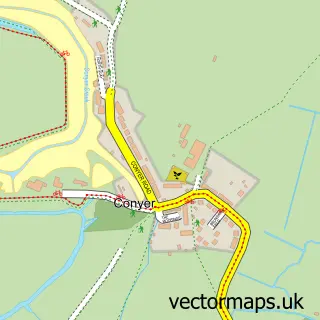
This Lynsted street map is a detailed vector street map covering a 750m x 750m area. Select a larger area to create and download your own vector street map of Lynsted.
The 750-metre map sample for Lynsted covers 154 mapped buildings and approximately 10.2 km of road detail, of which 6 named roads are named. The immediate area includes 1 school, 1 pub and 2 MOT stations within 2 miles. The wider area around Lynsted features 1 food and drink venue and 1 campsite within 2 miles. To create a larger or custom map of Lynsted, the map builder lets you define your own coverage area and download editable SVG, PDF and PNG files.
Create a larger editable map of Lynsted
Choose any area you need and generate a high-quality vector map instantly. Perfect for print, planning, design, business and personal use.

This Lynsted street map in Kent is available as downloadable SVG, PDF and PNG map files, or as a printed map for planning, business, display, education, local information and design work. You can also create a larger custom map area using the map selector.
What this Lynsted map sample shows
Lynsted lies within Lynsted With Kingsdown Cp parish, part of Teynham And Lynsted ward in the Swale District (B) local authority area. The postcode geography for this area includes the ME postcode area, the ME9 postcode district and the ME9 0 postcode sector. Residents fall under the Nhs Kent And Medway Integrated Care Board for NHS services.
Local features near Lynsted
Within 2 milesAmenities and services in and around Lynsted.
Administrative and postcode information for Lynsted
Lynsted lies within Lynsted With Kingsdown Cp parish, part of Teynham And Lynsted ward in the Swale District (B) local authority area. The postcode geography for this area includes the ME postcode area, the ME9 postcode district and the ME9 0 postcode sector. Residents fall under the Nhs Kent And Medway Integrated Care Board for NHS services.
Nearby street map samples around Lynsted

More street maps in Kent
750 metre map area coverage
Boundary, postcode and point of interest information for the 750m x 750m rectangle centred on this sample map.
Boundaries containing map centre
Constituency: Faversham and Mid Kent Co Const
County: Kent County
District: Swale District (B)
Icb: NHS Kent and Medway ICB
Parish: Lynsted with Kingsdown CP
Police Force: kent
Postcode District: ME9
Postcode Sector: ME9 0
Ward: Teynham and Lynsted Ward
Nearby boundaries intersecting sample
No additional intersecting boundaries found.
Postcode coverage
POI category counts
Advertising Agency: 2
Assisted Living Facility: 2
Anglican Church: 1
Auto Company: 1
Beach Equipment Rentals: 1
Church Cathedral: 1
Contractor: 1
Elementary School: 1
Nursery And Gardening: 1
Pet Breeder: 1
Sample points of interest
- Marketing & Business Development
- Perfectly Clear Marketing
- St Peter & St Paul, Lynsted
- Berkeley House
- Berkeley House Residential Home
- Uk mini spares ltd
- D.vidler Plant Hire
- Lynsted Church
- SPN Multitrade
- Lynsted & Norton County Primary School
- Amethyst Horticulture
- Lynsted Labs
Create a larger editable map of Lynsted
This sample shows only a 750 metre area. To create a larger map of Lynsted, use our map builder to choose your own coverage area, add titles and download editable SVG, PDF and PNG files.
Create a custom map of Lynsted