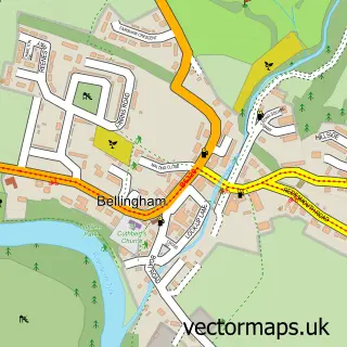
This Otterburn street map is a detailed vector street map covering a 750m x 750m area. Select a larger area to create and download your own vector street map of Otterburn.
The 750-metre map sample for Otterburn covers 129 mapped buildings and approximately 10.9 km of road detail, of which 3 named roads are named. The wider area around Otterburn features 2 tourism points of interest and 3 hotels. To create a larger or custom map of Otterburn, the map builder lets you define your own coverage area and download editable SVG, PDF and PNG files.
Create a larger editable map of Otterburn
Choose any area you need and generate a high-quality vector map instantly. Perfect for print, planning, design, business and personal use.

This Otterburn street map in Northumberland is available as downloadable SVG, PDF and PNG map files, or as a printed map for planning, business, display, education, local information and design work. You can also create a larger custom map area using the map selector.
What this Otterburn map sample shows
Otterburn lies within Otterburn Cp parish, part of Bellingham ward in the Northumberland local authority area. The postcode geography for this area includes the NE postcode area, the NE19 postcode district and the NE19 1 postcode sector. Residents fall under the Nhs North East And North Cumbria Integrated Care Board for NHS services.
Local features near Otterburn
Within 2 milesAmenities and services in and around Otterburn.
Administrative and postcode information for Otterburn
The local authority covering Otterburn is Northumberland, within the county of Northumberland. The settlement lies within Bellingham ward and Otterburn Cp civil parish. The NE19 postcode district and NE19 1 postcode sector serve the immediate area. NHS provision in the area is delivered through Northumbria Healthcare Nhs Foundation Trust.
Nearby street map samples around Otterburn


More street maps in Northumberland
750 metre map area coverage
Boundary, postcode and point of interest information for the 750m x 750m rectangle centred on this sample map.
Boundaries containing map centre
Constituency: Hexham Co Const
District: Northumberland
Icb: NHS North East and North Cumbria ICB
Parish: Otterburn CP
Police Force: northumberland
Postcode District: NE19
Postcode Sector: NE19 1
Nearby boundaries intersecting sample
No additional intersecting boundaries found.
Postcode coverage
POI category counts
Hotel: 3
Bed And Breakfast: 2
Convenience Store: 2
Accommodation: 1
Anglican Church: 1
Armed Forces Branch: 1
Banks: 1
Building Supply Store: 1
Church Cathedral: 1
Clothing Store: 1
Sample points of interest
- William de Percy
- Otterburn: St John the Evangelist
- Otterburn Training Camp
- Lloyds Bank
- Bertie's of Otterburn
- Butterchurn Guest House
- George Stephenson
- St John the Evangelist's Church, Otterburn
- Otterburn Mill
- Premier
- Premier Border Reiver
- Albion Outdoors
Create a larger editable map of Otterburn
This sample shows only a 750 metre area. To create a larger map of Otterburn, use our map builder to choose your own coverage area, add titles and download editable SVG, PDF and PNG files.
Create a custom map of Otterburn