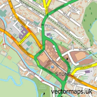
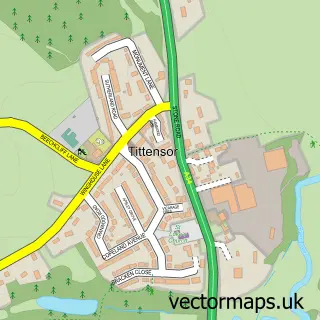
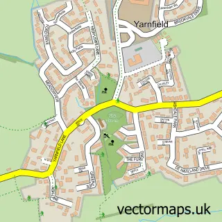
This Oulton street map is a detailed vector street map covering a 750m x 750m area. Select a larger area to create and download your own vector street map of Oulton.
The 750-metre map sample for Oulton covers 190 mapped buildings and approximately 11.1 km of road detail, of which 11 named roads are named. The immediate area includes 1 school, 2 GP surgeries within 2 miles, 3 pubs and 4 MOT stations within 2 miles. The wider area around Oulton features 3 food and drink venues. To create a larger or custom map of Oulton, the map builder lets you define your own coverage area and download editable SVG, PDF and PNG files.
Create a larger editable map of Oulton
Choose any area you need and generate a high-quality vector map instantly. Perfect for print, planning, design, business and personal use.

This Oulton street map in Staffordshire is available as downloadable SVG, PDF and PNG map files, or as a printed map for planning, business, display, education, local information and design work. You can also create a larger custom map area using the map selector.
What this Oulton map sample shows
Oulton lies within Stone Rural Cp parish, part of Swynnerton & Oulton ward in the Stafford District (B) local authority area. The postcode geography for this area includes the ST postcode area, the ST15 postcode district and the ST15 8 postcode sector. Residents fall under the Nhs Staffordshire And Stoke-On-Trent Integrated Care Board for NHS services.
Local features near Oulton
Within 2 milesAmenities and services in and around Oulton.
Administrative and postcode information for Oulton
Oulton lies within Stone Rural Cp parish, part of Swynnerton & Oulton ward in the Stafford District (B) local authority area. The postcode geography for this area includes the ST postcode area, the ST15 postcode district and the ST15 8 postcode sector. Residents fall under the Nhs Staffordshire And Stoke-On-Trent Integrated Care Board for NHS services.
Nearby street map samples around Oulton

More street maps in Staffordshire
750 metre map area coverage
Boundary, postcode and point of interest information for the 750m x 750m rectangle centred on this sample map.
Boundaries containing map centre
Constituency: Stoke-on-Trent South Co Const
County: Staffordshire County
District: Stafford District (B)
Icb: NHS Staffordshire and Stoke-on-Trent ICB
Parish: Stone Rural CP
Police Force: staffordshire
Postcode District: ST15
Postcode Sector: ST15 8
Ward: Swynnerton & Oulton Ward
Nearby boundaries intersecting sample
No additional intersecting boundaries found.
Postcode coverage
POI category counts
Pub: 3
Community Center: 2
Anglican Church: 1
Automotive Repair: 1
Bar: 1
Business Consulting: 1
Car Dealer: 1
Community Services Non Profits: 1
Elementary School: 1
Fair: 1
Sample points of interest
- Oulton S.John the Evangelist
- Clear Flow Charging
- The Wheatsheaf Inn
- Imstra
- Eco Motors
- Kingstone Village Hall
- Oulton Village Hall
- 1st Oulton Scout Group
- Oulton First School
- Alleyne's Sports Centre
- J J Tree Service
- Oulton Abbey Playgroup
Create a larger editable map of Oulton
This sample shows only a 750 metre area. To create a larger map of Oulton, use our map builder to choose your own coverage area, add titles and download editable SVG, PDF and PNG files.
Create a custom map of Oulton