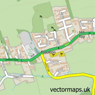
This Overton street map is a detailed vector street map covering a 750m x 750m area. Select a larger area to create and download your own vector street map of Overton.
The 750-metre map sample for Overton covers 251 mapped buildings and approximately 14.7 km of road detail, of which 17 named roads are named. The immediate area includes 2 GP surgeries within 2 miles, 1 pub and 7 MOT stations within 2 miles. The wider area around Overton features 2 food and drink venues. To create a larger or custom map of Overton, the map builder lets you define your own coverage area and download editable SVG, PDF and PNG files.
Create a larger editable map of Overton
Choose any area you need and generate a high-quality vector map instantly. Perfect for print, planning, design, business and personal use.

This Overton street map in West Yorkshire is available as downloadable SVG, PDF and PNG map files, or as a printed map for planning, business, display, education, local information and design work. You can also create a larger custom map area using the map selector.
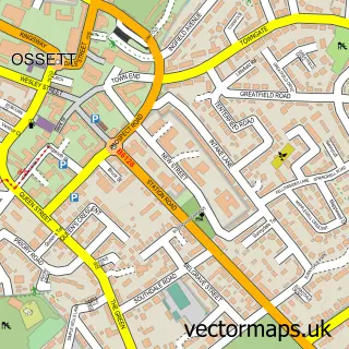
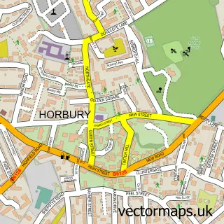
What this Overton map sample shows
Overton lies within Sitlington Cp parish, part of Wakefield Rural ward in the Wakefield District (B) local authority area. The postcode geography for this area includes the WF postcode area, the WF4 postcode district and the WF4 4 postcode sector. Residents fall under the Nhs West Yorkshire Integrated Care Board for NHS services.
Local features near Overton
Within 2 milesAmenities and services in and around Overton.
Administrative and postcode information for Overton
The local authority covering Overton is Wakefield District (B), within the county of West Yorkshire. The settlement lies within Wakefield Rural ward and Sitlington Cp civil parish. The WF4 postcode district and WF4 4 postcode sector serve the immediate area. NHS provision in the area is delivered through Mid Yorkshire Teaching Nhs Trust.
Nearby street map samples around Overton

More street maps in West Yorkshire
750 metre map area coverage
Boundary, postcode and point of interest information for the 750m x 750m rectangle centred on this sample map.
Boundaries containing map centre
Constituency: Ossett and Denby Dale Co Const
District: Wakefield District (B)
Icb: NHS West Yorkshire ICB
Parish: Sitlington CP
Police Force: west yorkshire
Postcode District: WF4
Postcode Sector: WF4 4
Ward: Wakefield Rural Ward
Nearby boundaries intersecting sample
No additional intersecting boundaries found.
Postcode coverage
POI category counts
Sports Club And League: 3
Beauty Salon: 2
Building Supply Store: 2
Anglican Church: 1
Animal Shelter: 1
Beauty Product Supplier: 1
Church Cathedral: 1
Coffee Shop: 1
Contractor: 1
Convenience Store: 1
Sample points of interest
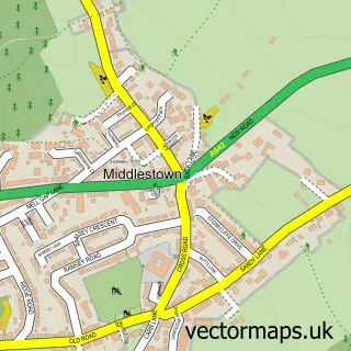
- St Luke's Middlestown (Overton)
- Waggin Tails Boarding Kennels
- Karens Beauty Room
- Karen's Beauty Room
- Kudos Hair & Beauty
- 1st Call Mechanical Electrical
- Total Cleaning Solutions
- St Luke Overton
- Seed Room
- Webfell Minerals
- Overton Stores
- Efficient Office Training
Create a larger editable map of Overton
This sample shows only a 750 metre area. To create a larger map of Overton, use our map builder to choose your own coverage area, add titles and download editable SVG, PDF and PNG files.
Create a custom map of Overton