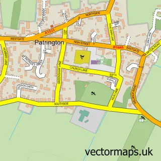
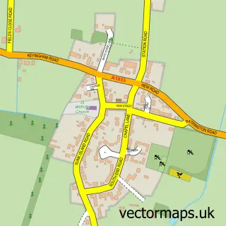
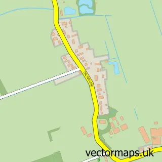
This Patrington Haven street map is a detailed vector street map covering a 750m x 750m area. Select a larger area to create and download your own vector street map of Patrington Haven.
The 750-metre map sample for Patrington Haven covers 89 mapped buildings and approximately 8.0 km of road detail, of which 7 named roads are named. The immediate area includes 1 pub and 1 MOT station within 2 miles. The wider area around Patrington Haven features 1 food and drink venue and 1 hotel. To create a larger or custom map of Patrington Haven, the map builder lets you define your own coverage area and download editable SVG, PDF and PNG files.
Create a larger editable map of Patrington Haven
Choose any area you need and generate a high-quality vector map instantly. Perfect for print, planning, design, business and personal use.

This Patrington Haven street map in East Riding of Yorkshire is available as downloadable SVG, PDF and PNG map files, or as a printed map for planning, business, display, education, local information and design work. You can also create a larger custom map area using the map selector.
What this Patrington Haven map sample shows
Patrington Haven lies within Patrington Cp parish, part of South East Holderness ward in the East Riding Of Yorkshire local authority area. The postcode geography for this area includes the HU postcode area, the HU12 postcode district and the HU12 0 postcode sector. Residents fall under the Nhs Humber And North Yorkshire Integrated Care Board for NHS services.
Local features near Patrington Haven
Within 2 milesAmenities and services in and around Patrington Haven.
Administrative and postcode information for Patrington Haven
Patrington Haven lies within Patrington Cp parish, part of South East Holderness ward in the East Riding Of Yorkshire local authority area. The postcode geography for this area includes the HU postcode area, the HU12 postcode district and the HU12 0 postcode sector. Residents fall under the Nhs Humber And North Yorkshire Integrated Care Board for NHS services.
Nearby street map samples around Patrington Haven

More street maps in East Riding of Yorkshire
750 metre map area coverage
Boundary, postcode and point of interest information for the 750m x 750m rectangle centred on this sample map.
Boundaries containing map centre
Constituency: Beverley and Holderness Co Const
District: East Riding of Yorkshire
Icb: NHS Humber and North Yorkshire ICB
Parish: Patrington CP
Police Force: humberside
Postcode District: HU12
Postcode Sector: HU12 0
Ward: South East Holderness Ward
Nearby boundaries intersecting sample
No additional intersecting boundaries found.
Postcode coverage
POI category counts
Auto Upholstery: 1
Beauty Salon: 1
Gift Shop: 1
Holiday Rental Home: 1
Hotel: 1
Mobile Home Park: 1
Physical Therapy: 1
Pub: 1
Sample points of interest
- Chesters Curtains
- elemis
- Sweetie Pie Gifts
- 7 Park Lane
- Number Two The Mall Holiday Home
- Patrington Haven Leisure Park
- Onebody Physiotherapy
- Burns Head
Create a larger editable map of Patrington Haven
This sample shows only a 750 metre area. To create a larger map of Patrington Haven, use our map builder to choose your own coverage area, add titles and download editable SVG, PDF and PNG files.
Create a custom map of Patrington Haven