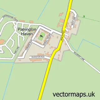
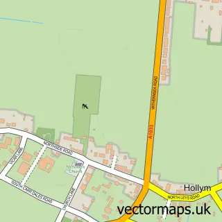
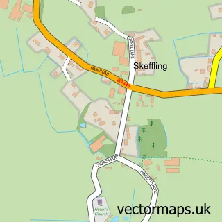
This Patrington street map is a detailed vector street map covering a 750m x 750m area. Select a larger area to create and download your own vector street map of Patrington.
The 750-metre map sample for Patrington covers 340 mapped buildings and approximately 16.0 km of road detail, of which 30 named roads are named. The immediate area includes 1 school, 2 pubs and 1 MOT station. The wider area around Patrington features 3 food and drink venues. To create a larger or custom map of Patrington, the map builder lets you define your own coverage area and download editable SVG, PDF and PNG files.
Create a larger editable map of Patrington
Choose any area you need and generate a high-quality vector map instantly. Perfect for print, planning, design, business and personal use.

This Patrington street map in East Riding of Yorkshire is available as downloadable SVG, PDF and PNG map files, or as a printed map for planning, business, display, education, local information and design work. You can also create a larger custom map area using the map selector.
What this Patrington map sample shows
Patrington lies within Patrington Cp parish, part of South East Holderness ward in the East Riding Of Yorkshire local authority area. The postcode geography for this area includes the HU postcode area, the HU12 postcode district and the HU12 0 postcode sector. Residents fall under the Nhs Humber And North Yorkshire Integrated Care Board for NHS services.
Local features near Patrington
Within 2 milesAmenities and services in and around Patrington.
Administrative and postcode information for Patrington
The local authority covering Patrington is East Riding Of Yorkshire, within the county of East Riding Of Yorkshire. The settlement lies within South East Holderness ward and Patrington Cp civil parish. The HU12 postcode district and HU12 0 postcode sector serve the immediate area. NHS provision in the area is delivered through Hull University Teaching Hospitals Nhs Trust.
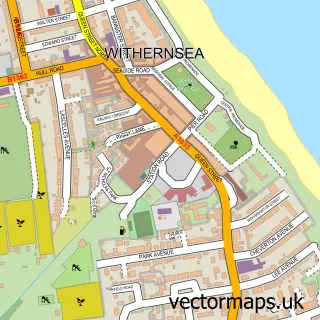
Nearby street map samples around Patrington

More street maps in East Riding of Yorkshire
750 metre map area coverage
Boundary, postcode and point of interest information for the 750m x 750m rectangle centred on this sample map.
Boundaries containing map centre
Constituency: Beverley and Holderness Co Const
District: East Riding of Yorkshire
Icb: NHS Humber and North Yorkshire ICB
Parish: Patrington CP
Police Force: humberside
Postcode District: HU12
Postcode Sector: HU12 0
Ward: South East Holderness Ward
Nearby boundaries intersecting sample
No additional intersecting boundaries found.
Postcode coverage
POI category counts
Convenience Store: 4
Arts And Crafts: 2
Bakery: 2
Beauty Salon: 2
Church Cathedral: 2
Currency Exchange: 2
Food Delivery Service: 2
Pub: 2
Veterinarian: 2
Accommodation: 1
Sample points of interest
- Patrington East Yorkshire
- Patrington AFC
- St. Patrick, Patrington
- Frank Hill & Son Architectural -Carl Chapman
- Gert And Daisy
- The Black Sheep and Dog
- Bleak House
- Cakey Bakey Yum Yum
- Patrington Bakery
- Barclays Bank
- Beauty By Laura
- Bee-beautiful
Create a larger editable map of Patrington
This sample shows only a 750 metre area. To create a larger map of Patrington, use our map builder to choose your own coverage area, add titles and download editable SVG, PDF and PNG files.
Create a custom map of Patrington