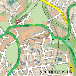
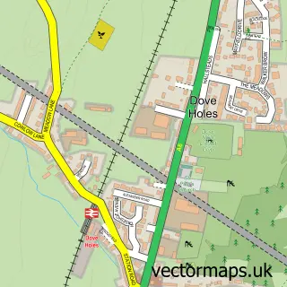
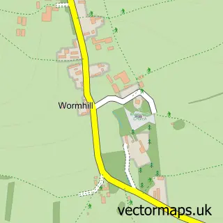
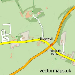
This Peak Dale street map is a detailed vector street map covering a 750m x 750m area. Select a larger area to create and download your own vector street map of Peak Dale.
The 750-metre map sample for Peak Dale covers 191 mapped buildings and approximately 11.9 km of road detail, of which 9 named roads are named. The immediate area includes 1 school and 4 MOT stations within 2 miles. To create a larger or custom map of Peak Dale, the map builder lets you define your own coverage area and download editable SVG, PDF and PNG files.
Create a larger editable map of Peak Dale
Choose any area you need and generate a high-quality vector map instantly. Perfect for print, planning, design, business and personal use.

This Peak Dale street map in Derbyshire is available as downloadable SVG, PDF and PNG map files, or as a printed map for planning, business, display, education, local information and design work. You can also create a larger custom map area using the map selector.
What this Peak Dale map sample shows
Peak Dale lies within Wormhill Cp parish, part of Limestone Peak ward in the High Peak District (B) local authority area. The postcode geography for this area includes the SK postcode area, the SK17 postcode district and the SK17 8 postcode sector. Residents fall under the Nhs Derby And Derbyshire Integrated Care Board for NHS services.
Local features near Peak Dale
Within 2 milesAmenities and services in and around Peak Dale.
Administrative and postcode information for Peak Dale
Peak Dale lies within Wormhill Cp parish, part of Limestone Peak ward in the High Peak District (B) local authority area. The postcode geography for this area includes the SK postcode area, the SK17 postcode district and the SK17 8 postcode sector. Residents fall under the Nhs Derby And Derbyshire Integrated Care Board for NHS services.
Nearby street map samples around Peak Dale

More street maps in Derbyshire
750 metre map area coverage
Boundary, postcode and point of interest information for the 750m x 750m rectangle centred on this sample map.
Boundaries containing map centre
Constituency: High Peak Co Const
County: Derbyshire County
District: High Peak District (B)
Icb: NHS Derby and Derbyshire ICB
Parish: Wormhill CP
Police Force: derbyshire
Postcode District: SK17
Postcode Sector: SK17 8
Ward: Limestone Peak Ward
Nearby boundaries intersecting sample
Parish: Green Fairfield CP
Postcode coverage
POI category counts
American Restaurant: 1
Building Supply Store: 1
Elementary School: 1
Employment Agencies: 1
Janitorial Services: 1
Pet Groomer: 1
Post Office: 1
Property Management: 1
Social Service Organizations: 1
University Housing: 1
Sample points of interest
- Buffalo & Bun at The Queens, Dove Holes
- A B & Sons
- Peak Dale Primary School
- Talon Recruitment
- PW Tanking Services Ltd.
- Scragg's Dog Grooming
- Peak Dale Post Office
- Jazeta Properties
- Great Rocks Social Club | High Peak
- Jazeta Properties Ltd.
Create a larger editable map of Peak Dale
This sample shows only a 750 metre area. To create a larger map of Peak Dale, use our map builder to choose your own coverage area, add titles and download editable SVG, PDF and PNG files.
Create a custom map of Peak Dale