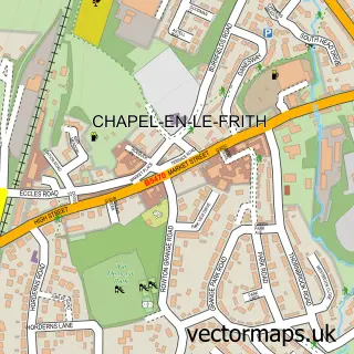
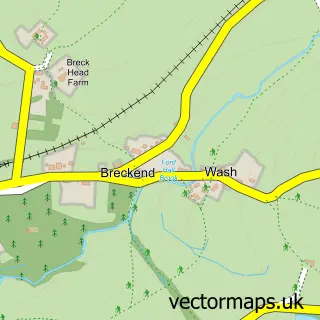
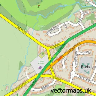
This Dove Holes street map is a detailed vector street map covering a 750m x 750m area. Select a larger area to create and download your own vector street map of Dove Holes.
The 750-metre map sample for Dove Holes covers 254 mapped buildings and approximately 15.1 km of road detail, of which 15 named roads are named. The immediate area includes 1 school, 1 railway station, 1 GP surgery within 2 miles and 2 MOT stations, with 6 within 2 miles. The wider area around Dove Holes features 2 tourism points of interest and 1 hotel. To create a larger or custom map of Dove Holes, the map builder lets you define your own coverage area and download editable SVG, PDF and PNG files.
Create a larger editable map of Dove Holes
Choose any area you need and generate a high-quality vector map instantly. Perfect for print, planning, design, business and personal use.

This Dove Holes street map in Derbyshire is available as downloadable SVG, PDF and PNG map files, or as a printed map for planning, business, display, education, local information and design work. You can also create a larger custom map area using the map selector.
What this Dove Holes map sample shows
Dove Holes lies within Chapel-En-Le-Frith Cp parish, part of Limestone Peak ward in the High Peak District (B) local authority area. The postcode geography for this area includes the SK postcode area, the SK17 postcode district and the SK17 8 postcode sector. Residents fall under the Nhs Derby And Derbyshire Integrated Care Board for NHS services.
Local features near Dove Holes
Within 2 milesAmenities and services in and around Dove Holes.
Administrative and postcode information for Dove Holes
Dove Holes lies within Chapel-En-Le-Frith Cp parish, part of Limestone Peak ward in the High Peak District (B) local authority area. The postcode geography for this area includes the SK postcode area, the SK17 postcode district and the SK17 8 postcode sector. Residents fall under the Nhs Derby And Derbyshire Integrated Care Board for NHS services.
Nearby street map samples around Dove Holes

More street maps in Derbyshire
750 metre map area coverage
Boundary, postcode and point of interest information for the 750m x 750m rectangle centred on this sample map.
Boundaries containing map centre
Constituency: High Peak Co Const
County: Derbyshire County
District: High Peak District (B)
Icb: NHS Derby and Derbyshire ICB
Parish: Chapel-en-le-Frith CP
Police Force: derbyshire
Postcode District: SK17
Postcode Sector: SK17 8
Ward: Limestone Peak Ward
Nearby boundaries intersecting sample
No additional intersecting boundaries found.
Postcode coverage
POI category counts
Automotive Repair: 3
Painting: 2
Pest Control Service: 2
Alternative Medicine: 1
Anglican Church: 1
Appliance Repair Service: 1
Arts And Entertainment: 1
Attractions And Activities: 1
Auto Body Shop: 1
Bar: 1
Sample points of interest
- The Natural Health Practice
- St Paul
- Gareth Burns
- Guy Fawkes Fuels, Buxton
- The Buxton Garden Trail
- Fletchers Accident Repair Centre
- MWF AUTO'S
- Stella Motors
- TEC The Exhaust Company
- Dove Jazz Club
- Nomow Ltd.
- High Peak Buses-Dove Holes opp Bus Depot
Create a larger editable map of Dove Holes
This sample shows only a 750 metre area. To create a larger map of Dove Holes, use our map builder to choose your own coverage area, add titles and download editable SVG, PDF and PNG files.
Create a custom map of Dove Holes