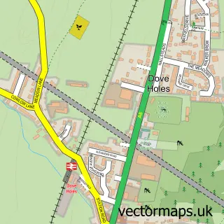
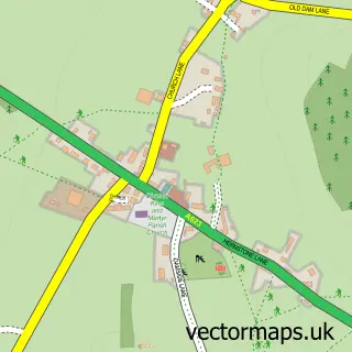
This Chapel-en-le-Frith street map is a detailed vector street map covering a 750m x 750m area. Select a larger area to create and download your own vector street map of Chapel-en-le-Frith.
The 750-metre map sample for Chapel-en-le-Frith covers 478 mapped buildings and approximately 21.8 km of road detail, of which 38 named roads are named. The immediate area includes 1 GP surgery, 9 pubs and 2 MOT stations, with 7 within 2 miles. The wider area around Chapel-en-le-Frith features 2 tourism points of interest and 13 food and drink venues. To create a larger or custom map of Chapel-en-le-Frith, the map builder lets you define your own coverage area and download editable SVG, PDF and PNG files.
Create a larger editable map of Chapel-en-le-Frith
Choose any area you need and generate a high-quality vector map instantly. Perfect for print, planning, design, business and personal use.

This Chapel-en-le-Frith street map in Derbyshire is available as downloadable SVG, PDF and PNG map files, or as a printed map for planning, business, display, education, local information and design work. You can also create a larger custom map area using the map selector.
What this Chapel-en-le-Frith map sample shows
Chapel-en-le-Frith lies within Chapel-En-Le-Frith Cp parish, part of Chapel East ward in the High Peak District (B) local authority area. The postcode geography for this area includes the SK postcode area, the SK23 postcode district and the SK23 0 postcode sector. Residents fall under the Nhs Derby And Derbyshire Integrated Care Board for NHS services.
Local features near Chapel-en-le-Frith
Within 2 milesAmenities and services in and around Chapel-en-le-Frith.
Administrative and postcode information for Chapel-en-le-Frith
Chapel-en-le-Frith lies within Chapel-En-Le-Frith Cp parish, part of Chapel East ward in the High Peak District (B) local authority area. The postcode geography for this area includes the SK postcode area, the SK23 postcode district and the SK23 0 postcode sector. Residents fall under the Nhs Derby And Derbyshire Integrated Care Board for NHS services.
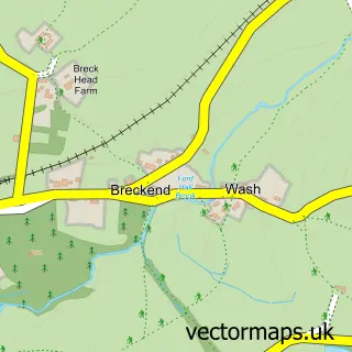
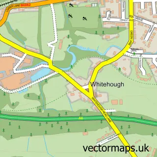
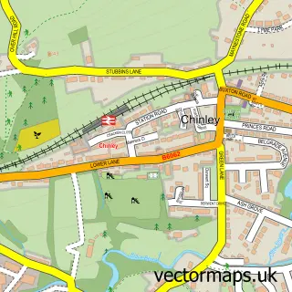
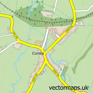
Nearby street map samples around Chapel-en-le-Frith

More street maps in Derbyshire
750 metre map area coverage
Boundary, postcode and point of interest information for the 750m x 750m rectangle centred on this sample map.
Boundaries containing map centre
Constituency: High Peak Co Const
County: Derbyshire County
District: High Peak District (B)
Icb: NHS Derby and Derbyshire ICB
Parish: Chapel-en-le-Frith CP
Police Force: derbyshire
Postcode District: SK23
Postcode Sector: SK23 0
Ward: Chapel West Ward
Nearby boundaries intersecting sample
Postcode Sector: SK23 9
Ward: Blackbrook Ward, Chapel East Ward
Postcode coverage
POI category counts
Pub: 9
Beauty Salon: 8
Professional Services: 7
Hair Salon: 6
Real Estate Agent: 5
Barber: 4
Building Supply Store: 4
Car Dealer: 4
Flowers And Gifts Shop: 4
Rental Kiosks: 4
Sample points of interest
- Stoney Philbin and Company
- ZSG Bookkeeping Ltd
- Lisa Rutter Naturopath
- Smokey Joes
- St Thomas Becket Church
- Blythe House Hospice Shop
- The Cooperative Food (BF) Chapel-En-Le-Frith
- Townend Community Garden
- Chapel Garage
- HD Restorations Ltd
- Em & Ted
- NatWest
Create a larger editable map of Chapel-en-le-Frith
This sample shows only a 750 metre area. To create a larger map of Chapel-en-le-Frith, use our map builder to choose your own coverage area, add titles and download editable SVG, PDF and PNG files.
Create a custom map of Chapel-en-le-Frith