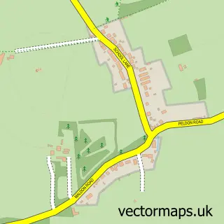
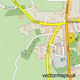
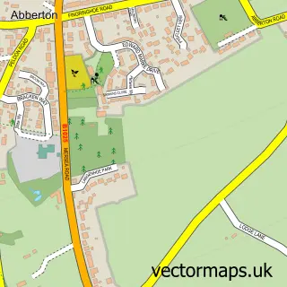
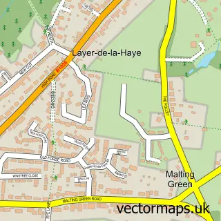
This Peldon street map is a detailed vector street map covering a 750m x 750m area. Select a larger area to create and download your own vector street map of Peldon.
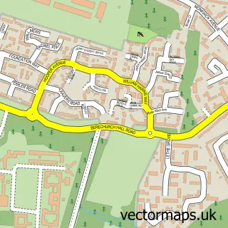
The 750-metre map sample for Peldon covers 181 mapped buildings and approximately 11.2 km of road detail, of which 7 named roads are named. The immediate area includes 1 pub and 1 MOT station within 2 miles. The wider area around Peldon features 1 tourism point of interest and 1 food and drink venue. To create a larger or custom map of Peldon, the map builder lets you define your own coverage area and download editable SVG, PDF and PNG files.
Create a larger editable map of Peldon
Choose any area you need and generate a high-quality vector map instantly. Perfect for print, planning, design, business and personal use.

This Peldon street map in Essex is available as downloadable SVG, PDF and PNG map files, or as a printed map for planning, business, display, education, local information and design work. You can also create a larger custom map area using the map selector.
What this Peldon map sample shows
Peldon lies within Peldon Cp parish, part of Mersea And Pyefleet ward in the Colchester District (B) local authority area. The postcode geography for this area includes the CO postcode area, the CO5 postcode district and the CO5 7 postcode sector. Residents fall under the Nhs Suffolk And North East Essex Integrated Care Board for NHS services.
Local features near Peldon
Within 2 milesAmenities and services in and around Peldon.
Administrative and postcode information for Peldon
Peldon lies within Peldon Cp parish, part of Mersea And Pyefleet ward in the Colchester District (B) local authority area. The postcode geography for this area includes the CO postcode area, the CO5 postcode district and the CO5 7 postcode sector. Residents fall under the Nhs Suffolk And North East Essex Integrated Care Board for NHS services.
Nearby street map samples around Peldon

More street maps in Essex
750 metre map area coverage
Boundary, postcode and point of interest information for the 750m x 750m rectangle centred on this sample map.
Boundaries containing map centre
Constituency: Harwich and North Essex Co Const
County: Essex County
District: Colchester District (B)
Icb: NHS Essex ICB
Parish: Peldon CP
Police Force: essex
Postcode District: CO5
Postcode Sector: CO5 7
Ward: Mersea & Pyefleet Ward
Nearby boundaries intersecting sample
No additional intersecting boundaries found.
Postcode coverage
POI category counts
Professional Services: 4
Preschool: 2
Anglican Church: 1
Automotive Dealer: 1
Bar: 1
Business Management Services: 1
Charity Organization: 1
Driving School: 1
Event Planning: 1
Farm: 1
Sample points of interest
- Peldon: St Mary The Virgin
- Hosplant Sales Ltd
- Peldon Plough
- Sixty Four Deluxe Ltd.
- Friends of St. Mary's
- Peter j clark driving school
- Peldon Village Hall
- Peldon Hall Farm
- Just Trees Limited
- Anita Philpott
- St Ives Barns
- Alchemy Gothic Jewellery, Gifts, Clothing and Accessories
Create a larger editable map of Peldon
This sample shows only a 750 metre area. To create a larger map of Peldon, use our map builder to choose your own coverage area, add titles and download editable SVG, PDF and PNG files.
Create a custom map of Peldon