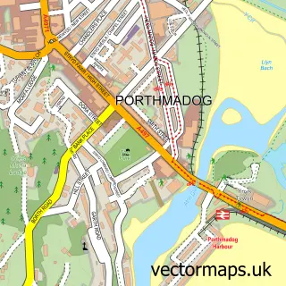
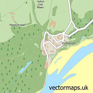
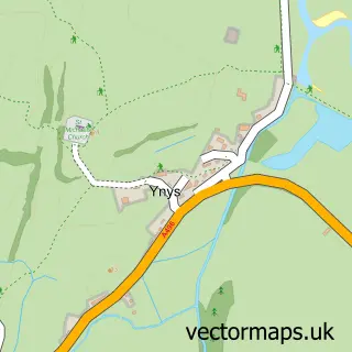
This Penrhyndeudraeth street map is a detailed vector street map covering a 750m x 750m area. Select a larger area to create and download your own vector street map of Penrhyndeudraeth.
The 750-metre map sample for Penrhyndeudraeth covers 264 mapped buildings and approximately 15.3 km of road detail, of which 10 named roads are named. The immediate area includes 1 school, 1 railway station, 2 pubs and 1 MOT station, with 3 within 2 miles. The wider area around Penrhyndeudraeth features 7 tourism points of interest, 4 food and drink venues and 1 hotel. To create a larger or custom map of Penrhyndeudraeth, the map builder lets you define your own coverage area and download editable SVG, PDF and PNG files.
Create a larger editable map of Penrhyndeudraeth
Choose any area you need and generate a high-quality vector map instantly. Perfect for print, planning, design, business and personal use.

This Penrhyndeudraeth street map in Gwynedd is available as downloadable SVG, PDF and PNG map files, or as a printed map for planning, business, display, education, local information and design work. You can also create a larger custom map area using the map selector.
What this Penrhyndeudraeth map sample shows
Penrhyndeudraeth lies within Penrhyndeudraeth Community parish, part of Penrhyndeudraeth ward in the Gwynedd - Gwynedd local authority area. The postcode geography for this area includes the LL postcode area, the LL48 postcode district and the LL48 6 postcode sector. Residents fall under the Betsi Cadwaladr University Health Board for NHS services.
Local features near Penrhyndeudraeth
Within 2 milesAmenities and services in and around Penrhyndeudraeth.
Administrative and postcode information for Penrhyndeudraeth
The local authority covering Penrhyndeudraeth is Gwynedd - Gwynedd, within the county of Gwynedd. The settlement lies within Penrhyndeudraeth ward and Penrhyndeudraeth Community civil parish. The LL48 postcode district and LL48 6 postcode sector serve the immediate area. NHS provision in the area is delivered through Betsi Cadwaladr University Health Board.
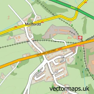
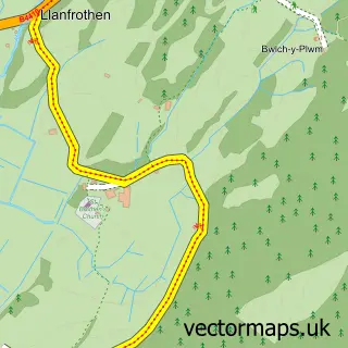
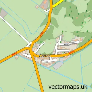
Nearby street map samples around Penrhyndeudraeth

More street maps in Gwynedd
750 metre map area coverage
Boundary, postcode and point of interest information for the 750m x 750m rectangle centred on this sample map.
Boundaries containing map centre
Constituency: Dwyfor Meirionnydd Co Const
District: Gwynedd - Gwynedd
Icb: Betsi Cadwaladr University
Parish: Penrhyndeudraeth Community
Police Force: north wales
Postcode District: LL48
Postcode Sector: LL48 6
Nearby boundaries intersecting sample
No additional intersecting boundaries found.
Postcode coverage
POI category counts
National Park: 4
Gas Station: 3
Train Station: 3
Baby Gear And Furniture: 2
Bar: 2
Bed And Breakfast: 2
Car Dealer: 2
Church Cathedral: 2
Convenience Store: 2
Dentist: 2
Sample points of interest
- Jason Clarke Sales & Repairs
- Port Meirion Village
- BR Spar Penrhyndeudreath (Lock swap)
- Gwynedd Windscreens Ltd
- Deudraeth Garage
- Babi Pur
- Babipur
- HSBC Bank
- The Baa Baa Bar
- Y Dderwen the Oak
- Barbwr Penrhyn
- Bliss Hair Studio
Create a larger editable map of Penrhyndeudraeth
This sample shows only a 750 metre area. To create a larger map of Penrhyndeudraeth, use our map builder to choose your own coverage area, add titles and download editable SVG, PDF and PNG files.
Create a custom map of Penrhyndeudraeth