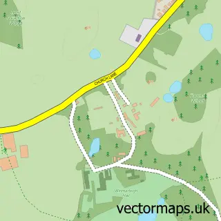
This Pilling street map is a detailed vector street map covering a 750m x 750m area. Select a larger area to create and download your own vector street map of Pilling.
The 750-metre map sample for Pilling covers 145 mapped buildings and approximately 8.5 km of road detail, of which 11 named roads are named. The immediate area includes 1 school and 2 MOT stations within 2 miles. The wider area around Pilling features 3 tourism points of interest and 1 food and drink venue. To create a larger or custom map of Pilling, the map builder lets you define your own coverage area and download editable SVG, PDF and PNG files.
Create a larger editable map of Pilling
Choose any area you need and generate a high-quality vector map instantly. Perfect for print, planning, design, business and personal use.

This Pilling street map in Lancashire is available as downloadable SVG, PDF and PNG map files, or as a printed map for planning, business, display, education, local information and design work. You can also create a larger custom map area using the map selector.
What this Pilling map sample shows
Pilling lies within Pilling Cp parish, part of Pilling ward in the Wyre District (B) local authority area. The postcode geography for this area includes the PR postcode area, the PR3 postcode district and the PR3 6 postcode sector. Residents fall under the Nhs Lancashire And South Cumbria Integrated Care Board for NHS services.
Local features near Pilling
Within 2 milesAmenities and services in and around Pilling.
Administrative and postcode information for Pilling
The local authority covering Pilling is Wyre District (B), within the county of Lancashire. The settlement lies within Pilling ward and Pilling Cp civil parish. The PR3 postcode district and PR3 6 postcode sector serve the immediate area. NHS provision in the area is delivered through Blackpool Teaching Hospitals Nhs Foundation Trust.
Nearby street map samples around Pilling

More street maps in Lancashire
750 metre map area coverage
Boundary, postcode and point of interest information for the 750m x 750m rectangle centred on this sample map.
Boundaries containing map centre
Constituency: Lancaster and Wyre Co Const
County: Lancashire County
District: Wyre District (B)
Icb: NHS Lancashire and South Cumbria ICB
Parish: Pilling CP
Police Force: lancashire
Postcode District: PR3
Postcode Sector: PR3 6
Ward: Pilling Ward
Nearby boundaries intersecting sample
No additional intersecting boundaries found.
Postcode coverage
POI category counts
Business Manufacturing And Supply: 2
Campground: 2
Church Cathedral: 2
Elementary School: 2
Accommodation: 1
Beauty And Spa: 1
Clothing Store: 1
Gardener: 1
Horse Boarding: 1
Landmark And Historical Building: 1
Sample points of interest
- Pilling Village
- Nails By Meg
- Northern Kilns
- Pilling Pottery
- Glenfield Caravan Park
- Moss Rose Camping at Black Hill Farm
- St John the Baptist Church
- St John the Baptist's Church
- JG.terapie.komplementarne
- Pilling Saint John's Church of England Voluntary Aided Primary School
- St Johns Cofe Primary
- GO Gardening and Organising
Create a larger editable map of Pilling
This sample shows only a 750 metre area. To create a larger map of Pilling, use our map builder to choose your own coverage area, add titles and download editable SVG, PDF and PNG files.
Create a custom map of Pilling