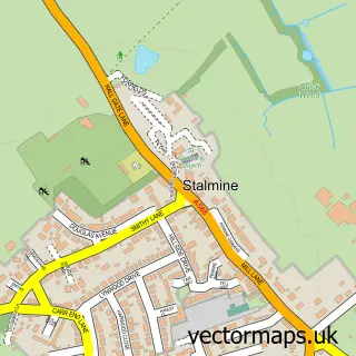
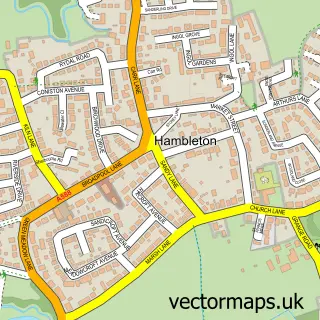
This Preesall street map is a detailed vector street map covering a 750m x 750m area. Select a larger area to create and download your own vector street map of Preesall.
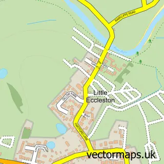
The 750-metre map sample for Preesall covers 184 mapped buildings and approximately 8.7 km of road detail, of which 16 named roads are named. The immediate area includes 1 primary school and 1 secondary school, 2 GP surgeries within 2 miles, 1 pub and 5 MOT stations within 2 miles. The wider area around Preesall features 1 tourism point of interest and 1 food and drink venue. To create a larger or custom map of Preesall, the map builder lets you define your own coverage area and download editable SVG, PDF and PNG files.
Create a larger editable map of Preesall
Choose any area you need and generate a high-quality vector map instantly. Perfect for print, planning, design, business and personal use.

This Preesall street map in Lancashire is available as downloadable SVG, PDF and PNG map files, or as a printed map for planning, business, display, education, local information and design work. You can also create a larger custom map area using the map selector.
What this Preesall map sample shows
Preesall lies within Preesall Cp parish, part of Preesall ward in the Wyre District (B) local authority area. The postcode geography for this area includes the FY postcode area, the FY6 postcode district and the FY6 0 postcode sector. Residents fall under the Nhs Lancashire And South Cumbria Integrated Care Board for NHS services.
Local features near Preesall
Within 2 milesAmenities and services in and around Preesall.
Administrative and postcode information for Preesall
Preesall lies within Preesall Cp parish, part of Preesall ward in the Wyre District (B) local authority area. The postcode geography for this area includes the FY postcode area, the FY6 postcode district and the FY6 0 postcode sector. Residents fall under the Nhs Lancashire And South Cumbria Integrated Care Board for NHS services.
Nearby street map samples around Preesall

More street maps in Lancashire
750 metre map area coverage
Boundary, postcode and point of interest information for the 750m x 750m rectangle centred on this sample map.
Boundaries containing map centre
Constituency: Lancaster and Wyre Co Const
County: Lancashire County
District: Wyre District (B)
Icb: NHS Lancashire and South Cumbria ICB
Parish: Preesall CP
Police Force: lancashire
Postcode District: FY6
Postcode Sector: FY6 0
Ward: Preesall Ward
Nearby boundaries intersecting sample
No additional intersecting boundaries found.
Postcode coverage
POI category counts
Funeral Services And Cemeteries: 2
Bed And Breakfast: 1
Education: 1
Elementary School: 1
Fishing Club: 1
Grocery Store: 1
High School: 1
Landmark And Historical Building: 1
Pub: 1
Train Station: 1
Sample points of interest
- Saracens House
- TFS Training Consultants
- Preesall Fleetwood's Charity Church of England Primary School
- Long Acre Lakes
- Moons Funeral Service
- Moons Funeral Service
- Danielle's Delicate Dainties
- St Aidan's Church of England High School
- Preesall Mill
- The Black Bull
- Preesall railway station
- Saracens House
Create a larger editable map of Preesall
This sample shows only a 750 metre area. To create a larger map of Preesall, use our map builder to choose your own coverage area, add titles and download editable SVG, PDF and PNG files.
Create a custom map of Preesall