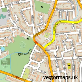
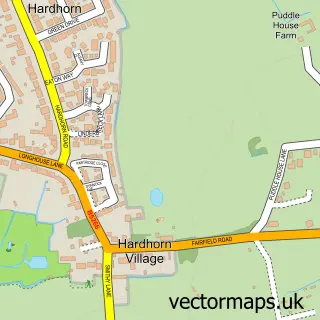
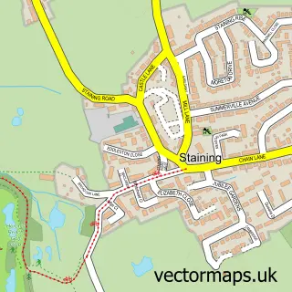
This Little Thornton street map is a detailed vector street map covering a 750m x 750m area. Select a larger area to create and download your own vector street map of Little Thornton.
The 750-metre map sample for Little Thornton covers 130 mapped buildings and approximately 5.1 km of road detail, of which 8 named roads are named. The immediate area includes 5 GP surgeries within 2 miles and 19 MOT stations within 2 miles. To create a larger or custom map of Little Thornton, the map builder lets you define your own coverage area and download editable SVG, PDF and PNG files.
Create a larger editable map of Little Thornton
Choose any area you need and generate a high-quality vector map instantly. Perfect for print, planning, design, business and personal use.

This Little Thornton street map in Lancashire is available as downloadable SVG, PDF and PNG map files, or as a printed map for planning, business, display, education, local information and design work. You can also create a larger custom map area using the map selector.
What this Little Thornton map sample shows
Little Thornton lies within Lancashire County parish, part of Stanah ward in the Wyre District (B) local authority area. The postcode geography for this area includes the FY postcode area, the FY5 postcode district and the FY5 5 postcode sector. Residents fall under the Nhs Lancashire And South Cumbria Integrated Care Board for NHS services.
Local features near Little Thornton
Within 2 milesAmenities and services in and around Little Thornton.
Administrative and postcode information for Little Thornton
The local authority covering Little Thornton is Wyre District (B), within the county of Lancashire. The settlement lies within Stanah ward and Lancashire County civil parish. The FY5 postcode district and FY5 5 postcode sector serve the immediate area. NHS provision in the area is delivered through Blackpool Teaching Hospitals Nhs Foundation Trust.
Nearby street map samples around Little Thornton

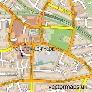
More street maps in Lancashire
750 metre map area coverage
Boundary, postcode and point of interest information for the 750m x 750m rectangle centred on this sample map.
Boundaries containing map centre
Constituency: Blackpool North and Fleetwood Boro Const
County: Lancashire County
District: Wyre District (B)
Icb: NHS Lancashire and South Cumbria ICB
Police Force: lancashire
Postcode District: FY5
Postcode Sector: FY5 5
Ward: Stanah Ward
Nearby boundaries intersecting sample
No additional intersecting boundaries found.
Postcode coverage
POI category counts
Acupuncture: 1
Caterer: 1
Sports Club And League: 1
Sample points of interest
- Thornton Acupuncture Clinic
- The Riverside Catering Company
- Blackpool and Fleetwood Yacht Club
Create a larger editable map of Little Thornton
This sample shows only a 750 metre area. To create a larger map of Little Thornton, use our map builder to choose your own coverage area, add titles and download editable SVG, PDF and PNG files.
Create a custom map of Little Thornton