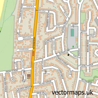
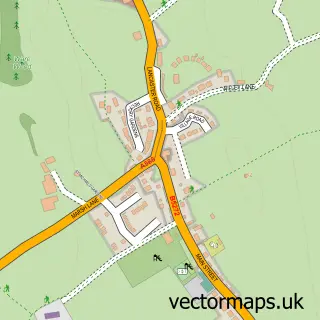
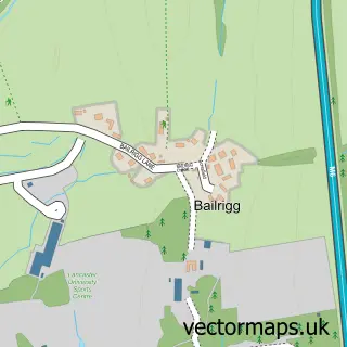
This Sunderland street map is a detailed vector street map covering a 750m x 750m area. Select a larger area to create and download your own vector street map of Sunderland.
The 750-metre map sample for Sunderland covers 30 mapped buildings and approximately 2.9 km of road detail, of which 1 named road are named. The immediate area includes 1 MOT station within 2 miles. The wider area around Sunderland features 1 tourism point of interest. To create a larger or custom map of Sunderland, the map builder lets you define your own coverage area and download editable SVG, PDF and PNG files.
Create a larger editable map of Sunderland
Choose any area you need and generate a high-quality vector map instantly. Perfect for print, planning, design, business and personal use.

This Sunderland street map in Lancashire is available as downloadable SVG, PDF and PNG map files, or as a printed map for planning, business, display, education, local information and design work. You can also create a larger custom map area using the map selector.
What this Sunderland map sample shows
Sunderland lies within Thurnham Cp parish, part of Ellel ward in the Lancaster District (B) local authority area. The postcode geography for this area includes the LA postcode area, the LA2 postcode district and the LA2 0 postcode sector. Residents fall under the Nhs Lancashire And South Cumbria Integrated Care Board for NHS services.
Local features near Sunderland
Within 2 milesAmenities and services in and around Sunderland.
Administrative and postcode information for Sunderland
Sunderland lies within Thurnham Cp parish, part of Ellel ward in the Lancaster District (B) local authority area. The postcode geography for this area includes the LA postcode area, the LA2 postcode district and the LA2 0 postcode sector. Residents fall under the Nhs Lancashire And South Cumbria Integrated Care Board for NHS services.
Nearby street map samples around Sunderland

More street maps in Lancashire
750 metre map area coverage
Boundary, postcode and point of interest information for the 750m x 750m rectangle centred on this sample map.
Boundaries containing map centre
Constituency: Morecambe and Lunesdale Co Const
County: Lancashire County
District: Lancaster District (B)
Parish: Overton CP
Police Force: lancashire
Postcode District: LA3
Postcode Sector: LA3 3
Ward: Overton Ward
Nearby boundaries intersecting sample
Constituency: Lancaster and Wyre Co Const
Icb: NHS Lancashire and South Cumbria ICB
Parish: Thurnham CP
Ward: Ellel Ward
Postcode coverage
POI category counts
Beauty And Spa: 1
Copywriting Service: 1
Grocery Store: 1
Landmark And Historical Building: 1
Sample points of interest
- Skin Revive Aesthetics
- SupremeEssays reputation
- Shiney Food Store
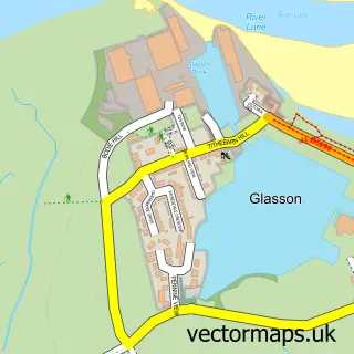
- Sunderland Point
Create a larger editable map of Sunderland
This sample shows only a 750 metre area. To create a larger map of Sunderland, use our map builder to choose your own coverage area, add titles and download editable SVG, PDF and PNG files.
Create a custom map of Sunderland