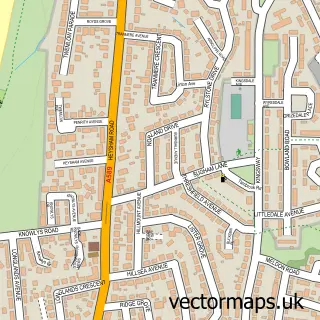
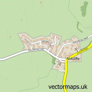
This Middleton street map is a detailed vector street map covering a 750m x 750m area. Select a larger area to create and download your own vector street map of Middleton.
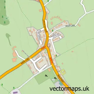
The 750-metre map sample for Middleton covers 148 mapped buildings and approximately 6.2 km of road detail, of which 8 named roads are named. The immediate area includes 1 GP surgery within 2 miles and 4 MOT stations within 2 miles. To create a larger or custom map of Middleton, the map builder lets you define your own coverage area and download editable SVG, PDF and PNG files.
Create a larger editable map of Middleton
Choose any area you need and generate a high-quality vector map instantly. Perfect for print, planning, design, business and personal use.

This Middleton street map in Lancashire is available as downloadable SVG, PDF and PNG map files, or as a printed map for planning, business, display, education, local information and design work. You can also create a larger custom map area using the map selector.
What this Middleton map sample shows
Middleton lies within Middleton Cp parish, part of Overton ward in the Lancaster District (B) local authority area. The postcode geography for this area includes the LA postcode area, the LA3 postcode district and the LA3 3 postcode sector. Residents fall under the Nhs Lancashire And South Cumbria Integrated Care Board for NHS services.
Local features near Middleton
Within 2 milesAmenities and services in and around Middleton.
Administrative and postcode information for Middleton
The local authority covering Middleton is Lancaster District (B), within the county of Lancashire. The settlement lies within Overton ward and Middleton Cp civil parish. The LA3 postcode district and LA3 3 postcode sector serve the immediate area. NHS provision in the area is delivered through University Hospitals Of Morecambe Bay Nhs Foundation Trust.
Nearby street map samples around Middleton

More street maps in Lancashire
750 metre map area coverage
Boundary, postcode and point of interest information for the 750m x 750m rectangle centred on this sample map.
Boundaries containing map centre
Constituency: Morecambe and Lunesdale Co Const
County: Lancashire County
District: Lancaster District (B)
Icb: NHS Lancashire and South Cumbria ICB
Parish: Middleton CP
Police Force: lancashire
Postcode District: LA3
Postcode Sector: LA3 3
Ward: Overton Ward
Nearby boundaries intersecting sample
No additional intersecting boundaries found.
Postcode coverage
POI category counts
Retail: 2
Arts And Entertainment: 1
Automotive Repair: 1
Business Manufacturing And Supply: 1
Electronics: 1
Engineering Services: 1
Freight And Cargo Service: 1
Linen: 1
Metal Fabricator: 1
Nature Reserve: 1
Sample points of interest
- Middleton Social Club
- Windscreens Direct - Uk ltd
- Fuel Proof Ltd
- Pat test north west
- Roll-tec Safety Ltd.
- Highway Express
- Sew Homely Bespoke Soft Furnishings
- T P Aspinall & Sons Ltd.
- Middleton Nature Reserve
- Simply Serviced
- Heysham Garden Products And Garden Centre
- Highway Express
Create a larger editable map of Middleton
This sample shows only a 750 metre area. To create a larger map of Middleton, use our map builder to choose your own coverage area, add titles and download editable SVG, PDF and PNG files.
Create a custom map of Middleton