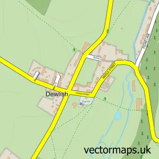
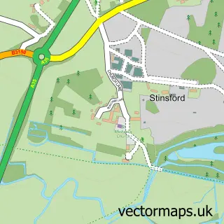
This Puddletown street map is a detailed vector street map covering a 750m x 750m area. Select a larger area to create and download your own vector street map of Puddletown.
The 750-metre map sample for Puddletown covers 303 mapped buildings and approximately 17.8 km of road detail, of which 28 named roads are named. The immediate area includes 1 school, 1 GP surgery and 1 pub. The wider area around Puddletown features 1 tourism point of interest and 1 food and drink venue. To create a larger or custom map of Puddletown, the map builder lets you define your own coverage area and download editable SVG, PDF and PNG files.
Create a larger editable map of Puddletown
Choose any area you need and generate a high-quality vector map instantly. Perfect for print, planning, design, business and personal use.

This Puddletown street map in Dorset is available as downloadable SVG, PDF and PNG map files, or as a printed map for planning, business, display, education, local information and design work. You can also create a larger custom map area using the map selector.
What this Puddletown map sample shows
Puddletown lies within Puddletown Cp parish, part of Puddletown & Lower Winterborne ward in the Dorset local authority area. The postcode geography for this area includes the DT postcode area, the DT2 postcode district and the DT2 8 postcode sector. Residents fall under the Nhs Dorset Integrated Care Board for NHS services.
Local features near Puddletown
Within 2 milesAmenities and services in and around Puddletown.
Administrative and postcode information for Puddletown
Puddletown lies within Puddletown Cp parish, part of Puddletown & Lower Winterborne ward in the Dorset local authority area. The postcode geography for this area includes the DT postcode area, the DT2 postcode district and the DT2 8 postcode sector. Residents fall under the Nhs Dorset Integrated Care Board for NHS services.
Nearby street map samples around Puddletown

More street maps in Dorset
750 metre map area coverage
Boundary, postcode and point of interest information for the 750m x 750m rectangle centred on this sample map.
Boundaries containing map centre
Constituency: North Dorset Co Const
District: Dorset
Icb: NHS Dorset ICB
Parish: Athelhampton and Puddletown CP
Police Force: dorset
Postcode District: DT2
Postcode Sector: DT2 8
Ward: Puddletown & Lower Winterborne Ward
Nearby boundaries intersecting sample
Postcode Sector: DT2 7
Postcode coverage
POI category counts
Church Cathedral: 3
Arts And Entertainment: 2
Assisted Living Facility: 2
Convenience Store: 2
Driving School: 2
Preschool: 2
Anglican Church: 1
Appliance Manufacturer: 1
Art Gallery: 1
Audiologist: 1
Sample points of interest
- Puddletown: St Mary the Virgin
- Peeters
- Bill Newton Artist
- Art Res Q
- S & G Lacey
- English Courtyard Association
- Walpole Court
- Specsavers Audiologists
- DH Autos
- The Hysterectomy Association
- Blue Vinny
- Weatherbury Cottages
Create a larger editable map of Puddletown
This sample shows only a 750 metre area. To create a larger map of Puddletown, use our map builder to choose your own coverage area, add titles and download editable SVG, PDF and PNG files.
Create a custom map of Puddletown