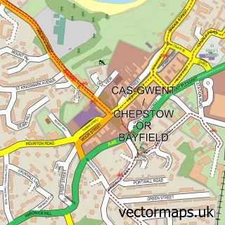
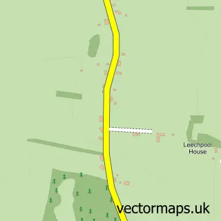
This Pwllmeyric street map is a detailed vector street map covering a 750m x 750m area. Select a larger area to create and download your own vector street map of Pwllmeyric.
The 750-metre map sample for Pwllmeyric covers 196 mapped buildings and approximately 11.1 km of road detail, of which 8 named roads are named. The immediate area includes 1 school, 2 GP surgeries within 2 miles and 5 MOT stations within 2 miles. The wider area around Pwllmeyric features 1 tourism point of interest, 1 food and drink venue and 1 hotel. To create a larger or custom map of Pwllmeyric, the map builder lets you define your own coverage area and download editable SVG, PDF and PNG files.
Create a larger editable map of Pwllmeyric
Choose any area you need and generate a high-quality vector map instantly. Perfect for print, planning, design, business and personal use.

This Pwllmeyric street map in Gwent is available as downloadable SVG, PDF and PNG map files, or as a printed map for planning, business, display, education, local information and design work. You can also create a larger custom map area using the map selector.
What this Pwllmeyric map sample shows
Pwllmeyric lies within Mathern Community parish, part of Shirenewton ward in the Sir Fynwy - Monmouthshire local authority area. The postcode geography for this area includes the NP postcode area, the NP16 postcode district and the NP16 6 postcode sector. Residents fall under the Aneurin Bevan University Health Board for NHS services.
Local features near Pwllmeyric
Within 2 milesAmenities and services in and around Pwllmeyric.
Administrative and postcode information for Pwllmeyric
Pwllmeyric lies within Mathern Community parish, part of Shirenewton ward in the Sir Fynwy - Monmouthshire local authority area. The postcode geography for this area includes the NP postcode area, the NP16 postcode district and the NP16 6 postcode sector. Residents fall under the Aneurin Bevan University Health Board for NHS services.
Nearby street map samples around Pwllmeyric


More street maps in Gwent
750 metre map area coverage
Boundary, postcode and point of interest information for the 750m x 750m rectangle centred on this sample map.
Boundaries containing map centre
Constituency: Monmouthshire Co Const
District: Sir Fynwy - Monmouthshire
Icb: Aneurin Bevan University
Parish: Mathern Community
Police Force: gwent
Postcode District: NP16
Postcode Sector: NP16 6
Nearby boundaries intersecting sample
No additional intersecting boundaries found.
Postcode coverage
POI category counts
Legal Services: 2
Building Supply Store: 1
Coffee Shop: 1
Convenience Store: 1
Engineering Services: 1
Event Planning: 1
Grocery Store: 1
Home Service: 1
Hotel: 1
Landmark And Historical Building: 1
Sample points of interest
- Gardenscapes
- Costa Express
- Londis
- Kwl Consulting Structural Engineers
- Mounton Brook Lodge
- Costcutter
- Wotton Donoghue Architects
- The Lodge Accommodation Chepstow
- Pwllmeyric
- Amicable Divorce Company
- Marie Dark Solicitors
- TG Convenience @ Texaco Pwllmeyric
Create a larger editable map of Pwllmeyric
This sample shows only a 750 metre area. To create a larger map of Pwllmeyric, use our map builder to choose your own coverage area, add titles and download editable SVG, PDF and PNG files.
Create a custom map of Pwllmeyric