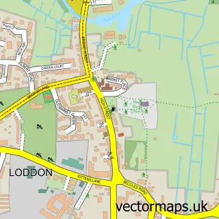
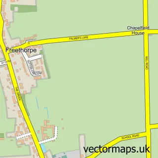
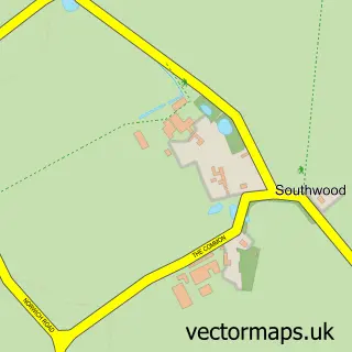
This Reedham street map is a detailed vector street map covering a 750m x 750m area. Select a larger area to create and download your own vector street map of Reedham.
The 750-metre map sample for Reedham covers 245 mapped buildings and approximately 7.8 km of road detail, of which 13 named roads are named. The immediate area includes 2 pubs. The wider area around Reedham features 3 food and drink venues and 1 campsite within 2 miles. To create a larger or custom map of Reedham, the map builder lets you define your own coverage area and download editable SVG, PDF and PNG files.
Create a larger editable map of Reedham
Choose any area you need and generate a high-quality vector map instantly. Perfect for print, planning, design, business and personal use.

This Reedham street map in Norfolk is available as downloadable SVG, PDF and PNG map files, or as a printed map for planning, business, display, education, local information and design work. You can also create a larger custom map area using the map selector.
What this Reedham map sample shows
Reedham lies within Reedham Cp parish, part of Marshes ward in the Broadland District local authority area. The postcode geography for this area includes the NR postcode area, the NR13 postcode district and the NR13 3 postcode sector. Residents fall under the Nhs Norfolk And Waveney Integrated Care Board for NHS services.
Local features near Reedham
Within 2 milesAmenities and services in and around Reedham.
Administrative and postcode information for Reedham
The local authority covering Reedham is Broadland District, within the county of Norfolk. The settlement lies within Marshes ward and Reedham Cp civil parish. The NR13 postcode district and NR13 3 postcode sector serve the immediate area. NHS provision in the area is delivered through Norfolk And Norwich University Hospitals Nhs Foundation Trust.
Nearby street map samples around Reedham

More street maps in Norfolk
750 metre map area coverage
Boundary, postcode and point of interest information for the 750m x 750m rectangle centred on this sample map.
Boundaries containing map centre
Constituency: Broadland and Fakenham Co Const
County: Norfolk County
District: Broadland District
Icb: NHS Norfolk and Waveney ICB
Parish: Reedham CP
Police Force: norfolk
Postcode District: NR13
Postcode Sector: NR13 3
Ward: Marshes Ward
Nearby boundaries intersecting sample
Constituency: South Norfolk Co Const
District: South Norfolk District
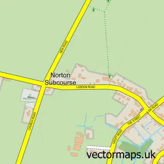
Parish: Norton Subcourse CP
Postcode District: NR14
Postcode Sector: NR14 6
Ward: Loddon & Chedgrave Ward
Postcode coverage
POI category counts
Gym: 2
Pub: 2
Shipping Center: 2
Arts And Crafts: 1
Beauty Salon: 1
Bridal Shop: 1
Business: 1
Business Equipment And Supply: 1
Cafe: 1
Delicatessen: 1
Sample points of interest
- Laura’s Art
- Tessa Beales at HARE
- Briars Tea Rooms and Bed and Breakfast
- Cobolt Systems Ltd
- Elite Lasers
- Reedham Quay
- Cannells By The River
- Dr Timms & Partners
- R.O.A.R Electrical
- Reedham Primary and Nursery School
- Manor Farm Christmas Trees
- Reedham Fish & Chip Shop
Create a larger editable map of Reedham
This sample shows only a 750 metre area. To create a larger map of Reedham, use our map builder to choose your own coverage area, add titles and download editable SVG, PDF and PNG files.
Create a custom map of Reedham