Vector Maps logo
Home Why it works Popular maps Districts Samples Customizer Create Your Map
VectorMaps.uk
Home Popular maps Districts Samples Customizer Create Your Map Privacy Disclaimer
Home / UK Maps / North Yorkshire / Reeth Map

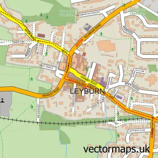
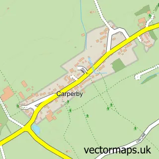
This Reeth street map is a detailed vector street map covering a 750m x 750m area. Select a larger area to create and download your own vector street map of Reeth.

Reeth is a village in North Yorkshire, in the Yorkshire And The Humber of England. Historically, the area formed part of Yorkshire. The settlement falls within the Richmond (Yorks) parliamentary constituency. It is served by the DL11 postcode district, wi

The 750-metre map sample for Reeth covers 171 mapped buildings and approximately 13.7 km of road detail, of which 10 named roads are named. The immediate area includes 1 GP surgery, 3 pubs and 1 MOT station. The wider area around Reeth features 7 tourism points of interest, 6 food and drink venues and 5 hotels. To create a larger or custom map of Reeth, the map builder lets you define your own coverage area and download editable SVG, PDF and PNG files.

171Buildings
13.7 kmRoads
10Named roads
378Residents within 2 miles
Create your own

Create a larger editable map of Reeth

Choose any area you need and generate a high-quality vector map instantly. Perfect for print, planning, design, business and personal use.

Choose any location
Editable SVG files
Any size up to A0
PDF, PNG & more
Instant download
High quality guaranteed
Create My Custom Map
Secure, private & no credit card required
Reeth Vector Street Map
750m Sample
Reeth vector street map sample showing roads, buildings and local features in a 750 metre preview area
Buy Reeth Map Print from £12.95 Buy Reeth Digital Map from £6

This Reeth street map in North Yorkshire is available as downloadable SVG, PDF and PNG map files, or as a printed map for planning, business, display, education, local information and design work. You can also create a larger custom map area using the map selector.

What this Reeth map sample shows

Reeth lies within Reeth, Fremington And Healaugh Cp parish, part of Lower Swaledale & Arkengarthdale ward in the North Yorkshire local authority area. The postcode geography for this area includes the DL postcode area, the DL11 postcode district and the DL11 6 postcode sector. Residents fall under the Nhs Humber And North Yorkshire Integrated Care Board for NHS services.

Local features near Reeth

Within 2 miles

Amenities and services in and around Reeth.

2 Campsites within 2 miles
1 GP surgeries 1 within 2 miles
1 MOT stations 1 within 2 miles
7 Tourism & leisure
6 Food & drink
3 Pubs
5 Hotels
1 Vehicle services

Counts are approximate and based on publicly available data.

Administrative and postcode information for Reeth

The local authority covering Reeth is North Yorkshire, within the county of North Yorkshire. The settlement lies within Lower Swaledale & Arkengarthdale ward and Reeth, Fremington And Healaugh Cp civil parish. The DL11 postcode district and DL11 6 postcode sector serve the immediate area. NHS provision in the area is delivered through South Tees Hospitals Nhs Foundation Trust.

Parish Reeth, Fremington and Healaugh CP
Ward Lower Swaledale & Arkengarthdale
District / local authority North Yorkshire
County North Yorkshire
Historic county Yorkshire
Postcode district DL11
Postcode sector DL11 6
Parliamentary constituency Richmond (Yorks)
Region Yorkshire and the Humber
Country England

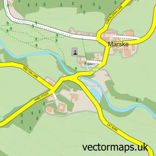
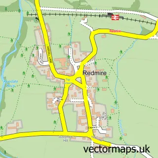
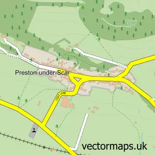
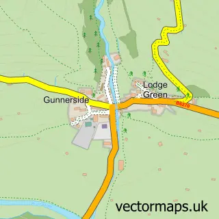
Nearby street map samples around Reeth

Street map sample of Leyburn, North Yorkshire Leyburn Town - North Yorkshire - 7.1 miles Street map sample of Ripon, North Yorkshire Ripon City - North Yorkshire - 24.3 miles Street map sample of Grinton, North Yorkshire Grinton Village - North Yorkshire - 0.7 miles Street map sample of Marrick, North Yorkshire Marrick Village - North Yorkshire - 2.5 miles Street map sample of Low Row, North Yorkshire Low Row Village - North Yorkshire - 3.4 miles Street map sample of Marske, North Yorkshire Marske Village - North Yorkshire - 4.1 miles Street map sample of Redmire, North Yorkshire Redmire Village - North Yorkshire - 5.0 miles Street map sample of Preston under Scar, North Yorkshire Preston under Scar Village - North Yorkshire - 5.5 miles Street map sample of Gunnerside, North Yorkshire Gunnerside Village - North Yorkshire - 5.5 miles Street map sample of Carperby, North Yorkshire Carperby Village - North Yorkshire - 6.2 miles

More street maps in North Yorkshire

Street map sample of Grinton, North Yorkshire Grinton Village - 0.7 miles Street map sample of Marrick, North Yorkshire Marrick Village - 2.5 miles Street map sample of Low Row, North Yorkshire Low Row Village - 3.4 miles Street map sample of Marske, North Yorkshire Marske Village - 4.1 miles Street map sample of Redmire, North Yorkshire Redmire Village - 5.0 miles

750 metre map area coverage

Boundary, postcode and point of interest information for the 750m x 750m rectangle centred on this sample map.

Boundaries containing map centre

Constituency: Richmond and Northallerton Co Const

District: North Yorkshire

Icb: NHS Humber and North Yorkshire ICB

Parish: Reeth, Fremington and Healaugh CP

Police Force: north yorkshire

Postcode District: DL11

Postcode Sector: DL11 6

Nearby boundaries intersecting sample
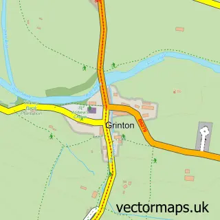
Parish: Grinton CP

Postcode coverage

DL11 DL11 6

POI category counts

Hotel: 5

Bed And Breakfast: 3

Cafe: 3

Holiday Rental Home: 3

Ice Cream Shop: 3

Pub: 3

Arts And Crafts: 2

Bakery: 2

Cottage: 2

Museum: 2

Sample points of interest

  • Reflex Training Adult Education
  • The Nutmeg Company Arts And Crafts
  • The Threshing Barn Arts And Crafts
  • Reeth Sheltered Housing Assisted Living Facility
  • Alfresco Adventures Attractions And Activities
  • Unipart Car Care Centre Automotive Repair
  • Reeth Bakery Bakery
  • Two Dales Bakery Bakery
  • Arkleside Country Guest House Bed And Breakfast
  • Ivy Cottage Bed And Breakfast
  • The Laurels Reeth Bed And Breakfast
  • Greensleeves Lawn Care Richmond Building Supply Store

Create a larger editable map of Reeth

This sample shows only a 750 metre area. To create a larger map of Reeth, use our map builder to choose your own coverage area, add titles and download editable SVG, PDF and PNG files.

Create a custom map of Reeth

Phone 01751 473136 | Copyright Vectormaps.uk 2026

Samples Customizer Privacy Disclaimer
Reeth Vector Street Map
Reeth enlarged street map sample showing a 750 metre preview area