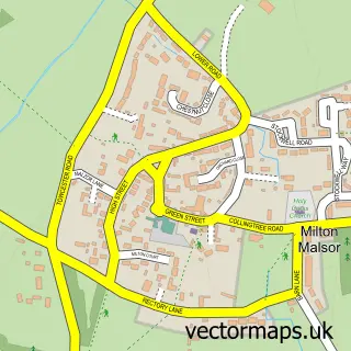
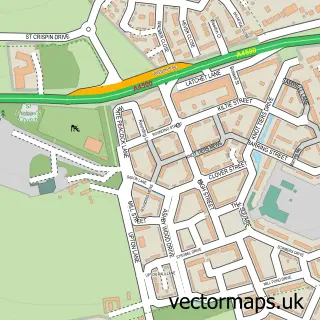
This Rothersthorpe street map is a detailed vector street map covering a 750m x 750m area. Select a larger area to create and download your own vector street map of Rothersthorpe.
The 750-metre map sample for Rothersthorpe covers 142 mapped buildings and approximately 17.5 km of road detail, of which 9 named roads are named. The immediate area includes 1 school, 1 pub and 4 MOT stations within 2 miles. The wider area around Rothersthorpe features 2 food and drink venues. To create a larger or custom map of Rothersthorpe, the map builder lets you define your own coverage area and download editable SVG, PDF and PNG files.
Create a larger editable map of Rothersthorpe
Choose any area you need and generate a high-quality vector map instantly. Perfect for print, planning, design, business and personal use.

This Rothersthorpe street map in Northamptonshire is available as downloadable SVG, PDF and PNG map files, or as a printed map for planning, business, display, education, local information and design work. You can also create a larger custom map area using the map selector.
What this Rothersthorpe map sample shows
Rothersthorpe lies within Rothersthorpe Cp parish, part of Harpole And Grange ward in the West Northamptonshire local authority area. The postcode geography for this area includes the NN postcode area, the NN7 postcode district and the NN7 3 postcode sector. Residents fall under the Nhs Northamptonshire Integrated Care Board for NHS services.
Local features near Rothersthorpe
Within 2 milesAmenities and services in and around Rothersthorpe.
Administrative and postcode information for Rothersthorpe
The local authority covering Rothersthorpe is West Northamptonshire, within the county of Northamptonshire. The settlement lies within Harpole And Grange ward and Rothersthorpe Cp civil parish. The NN7 postcode district and NN7 3 postcode sector serve the immediate area. NHS provision in the area is delivered through Northampton General Hospital Nhs Trust.
Nearby street map samples around Rothersthorpe


More street maps in Northamptonshire
750 metre map area coverage
Boundary, postcode and point of interest information for the 750m x 750m rectangle centred on this sample map.
Boundaries containing map centre
Constituency: South Northamptonshire Co Const
District: West Northamptonshire
Icb: NHS Northamptonshire ICB
Parish: Rothersthorpe CP
Police Force: northamptonshire
Postcode District: NN7
Postcode Sector: NN7 3
Ward: Campion Ward
Nearby boundaries intersecting sample
No additional intersecting boundaries found.
Postcode coverage
POI category counts
Business Office Supplies And Stationery: 2
Preschool: 2
Anglican Church: 1
Business To Business: 1
Business To Business Services: 1
Central Government Office: 1
Church Cathedral: 1
Education: 1
Elementary School: 1
Energy Company: 1
Sample points of interest
- St Peter & St Paul
- AT&T Email Customer Support Phone Number +1-800-234-6190
- AT&T Email Technical Support Number 1-800-234-6190
- C P L Distribution
- Into Print
- The Democratic Republic of Rothersthorpe
- Rothersthorpe Church
- Aspiration
- Rothersthorpe CE Primary
- Homefire - Rothersthorpe Depot
- With Love & Roses
- Network Surveyors & Valuers
Create a larger editable map of Rothersthorpe
This sample shows only a 750 metre area. To create a larger map of Rothersthorpe, use our map builder to choose your own coverage area, add titles and download editable SVG, PDF and PNG files.
Create a custom map of Rothersthorpe